Fires is a comprehensive wildfire information resource and atlas.
▶▶ WILDFIRE INFORMATION RESOURCE
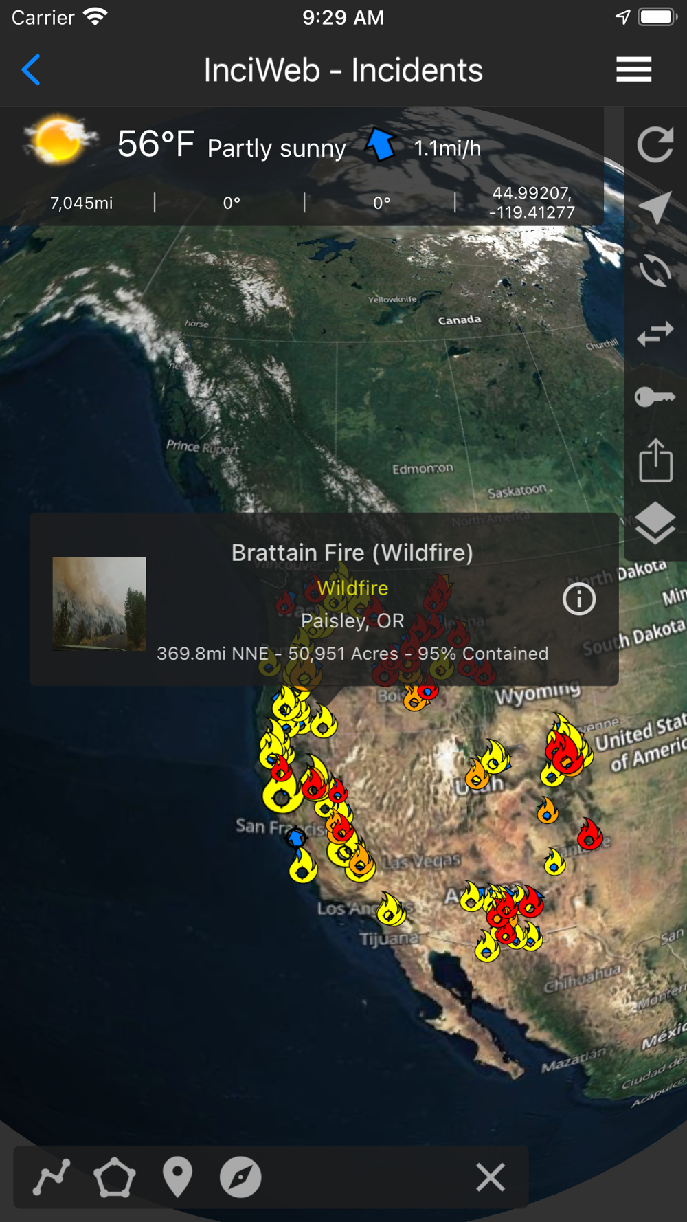
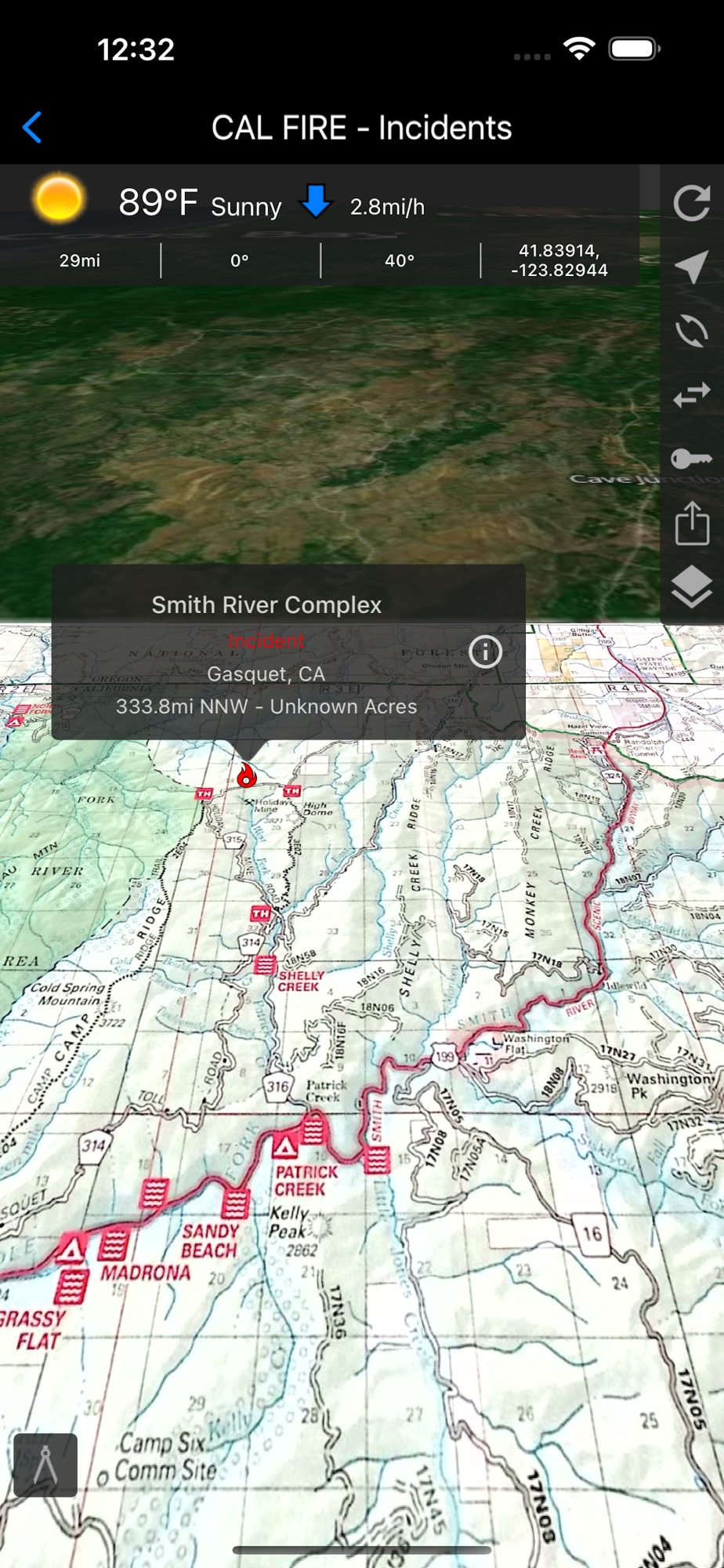
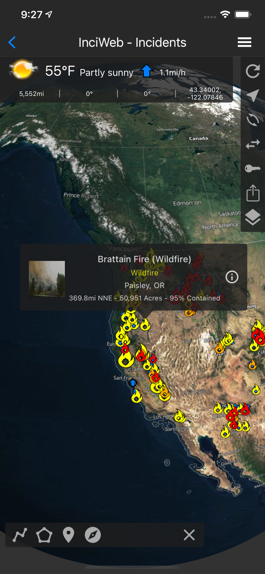
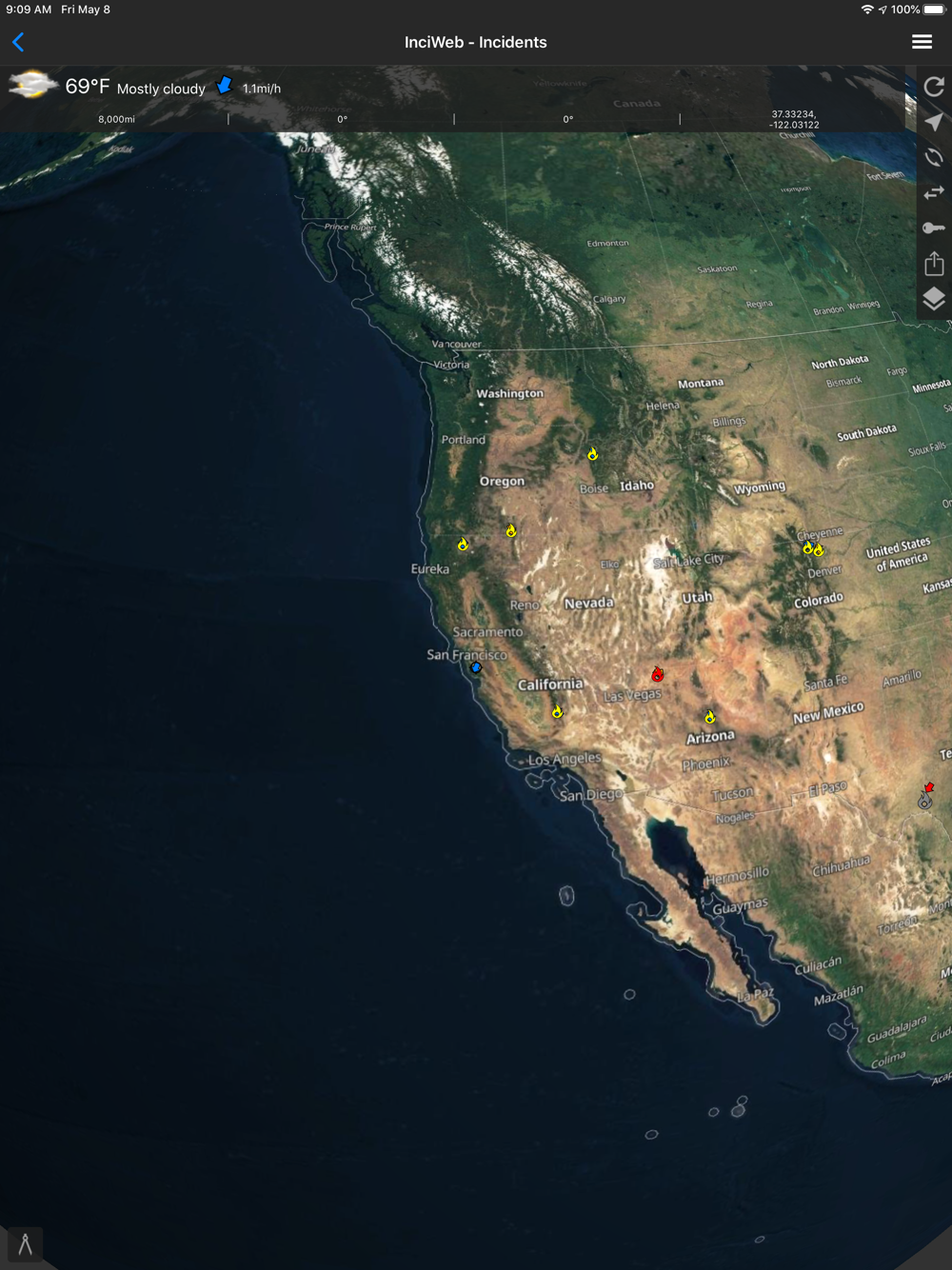
▶ Incident Details
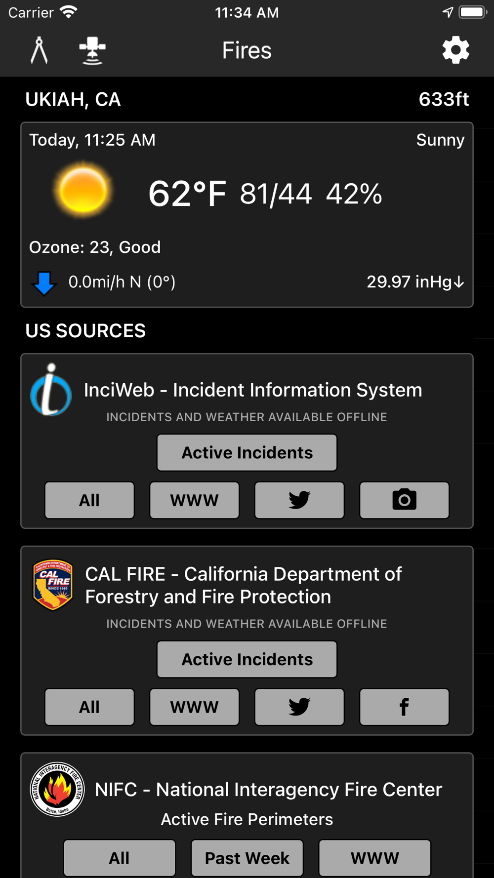
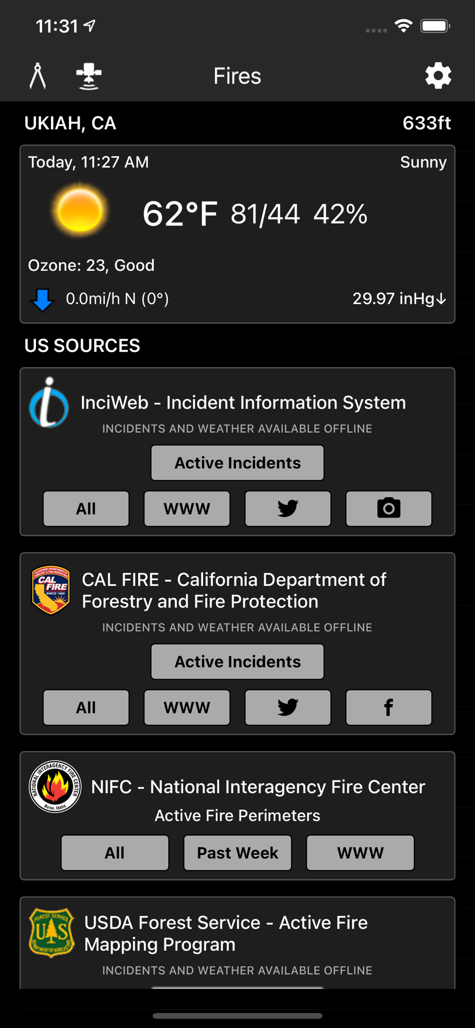
Fires provides maps, photos, and information about wildfires from several sources for the United States. View active wildfire perimeters or share wildfire information and high resolution photos.
• InciWeb
• CAL FIRE
• NIFC
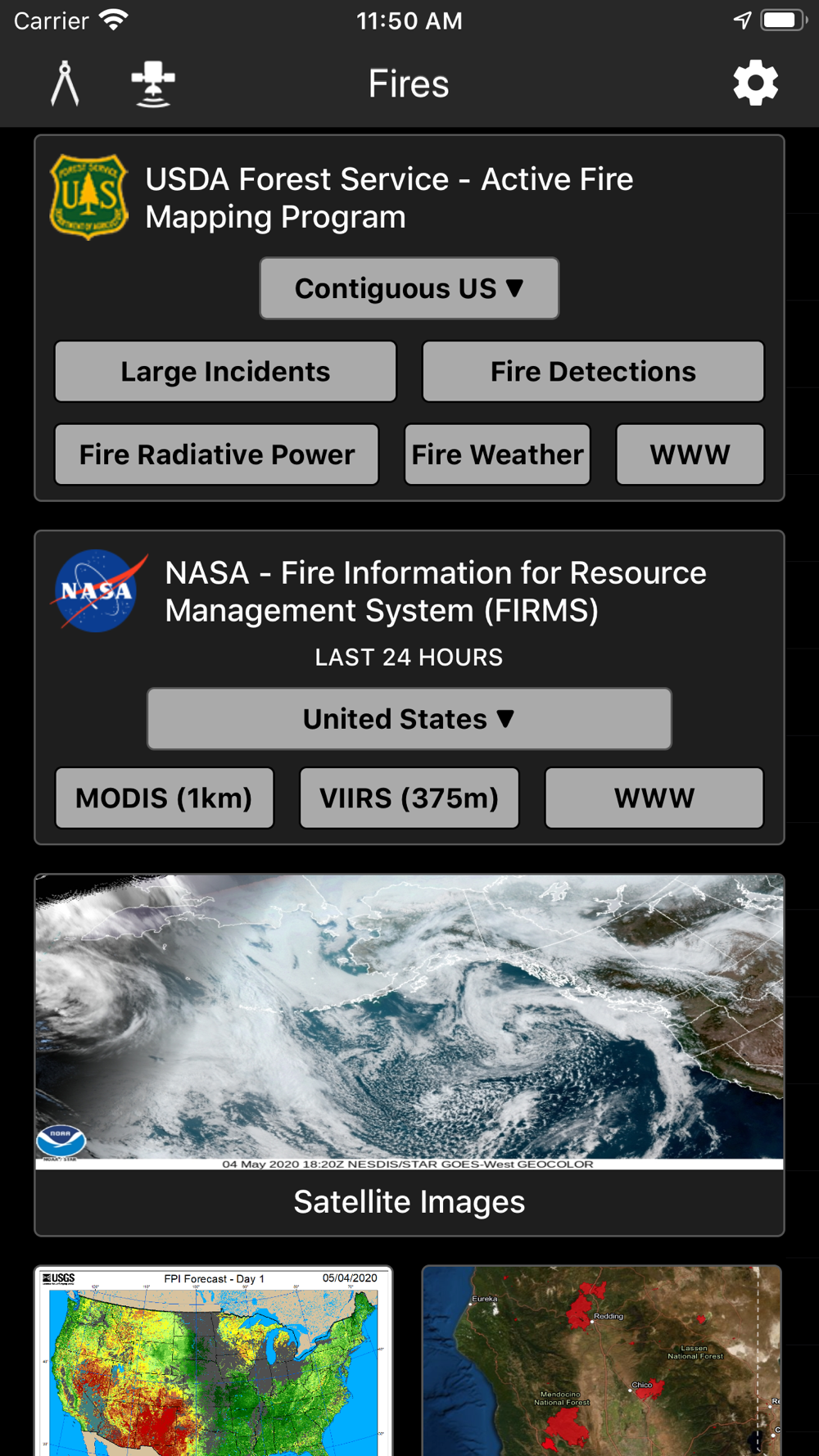
• US Forest Service
▶ Incident Notifications with Containment Updates
Fires will notify you when new incidents are downloaded within the maximum distance that you set from the source that you select.
• InciWeb
• CAL FIRE
• US Forest Service
▶ Offline Incident Mapping
Fires can automatically download incidents when the app is in the background from the source that you select.
• InciWeb
• CAL FIRE
• US Forest Service
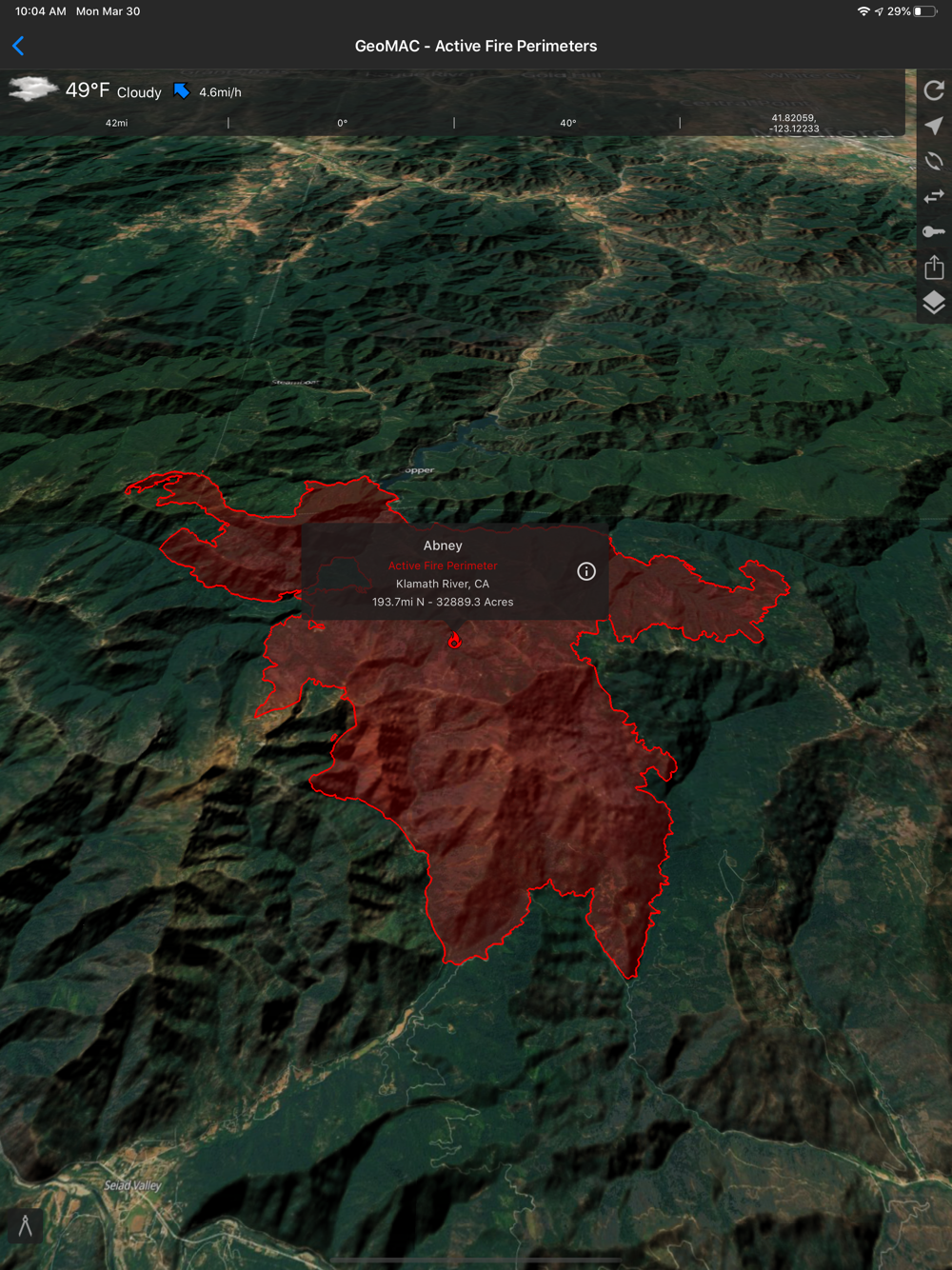
▶ Thermal Hotspots and Fire Activity
Fires allows you to interactively browse the full set of global active fire detections from MODIS and VIIRS.
• Collection-6 MODIS Active Fire Data
• VIIRS I-Band 375m Active Fire Data
• Active Fire Details
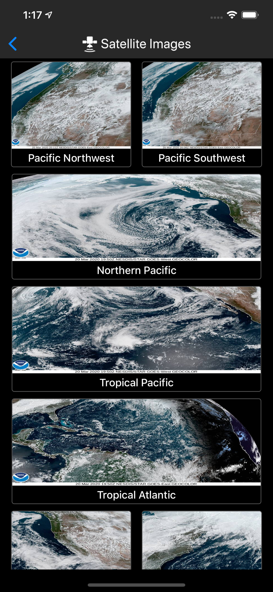
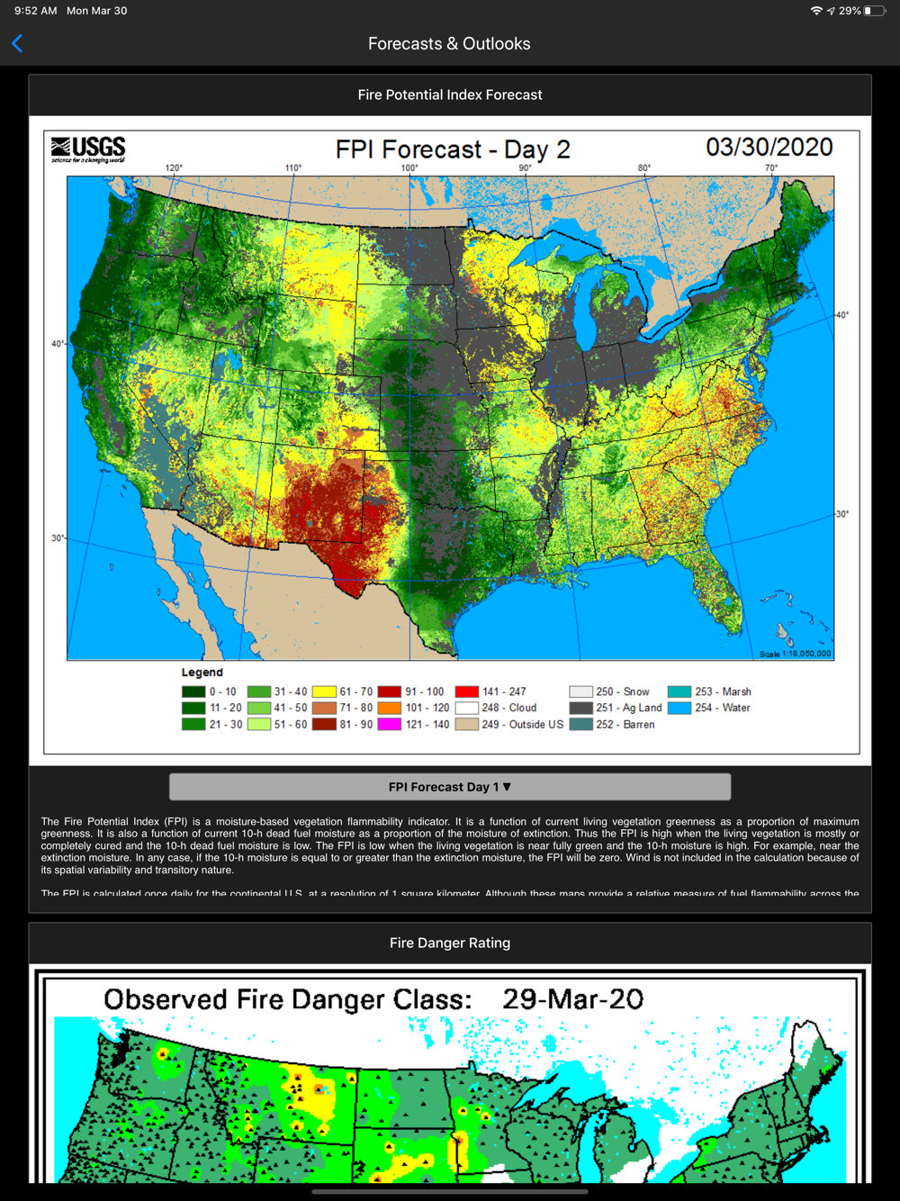
▶ GOES and Himawari Satellite Images and Animations
Fires provides extensive near real-time GOES (Geostationary Operational Environmental Satellite) imagery from NOAA.
• United States
• Pacific
• Atlantic
• Central America
• South America
• East Full Disk
• West Full Disk
▶ Local Weather Conditions
Fires gives you a summary of your current local weather conditions from AccuWeather for free without a subscription.
▶▶ ATLAS
▶ Offline 3D Maps and GPS
Fires will give you offline GPS functionality and 3D base maps when there is no network coverage.
• Several Base Maps
• Several Reference Maps with a focus on Northern California and the Pacific Northwest. We will be adding more maps for Southern California and the Pacific Southwest.
• Create Lines, Shapes, and Waypoints
• Navigate and trace your locations
▶▶ SUBSCRIPTIONS
Subscriptions automatically renew unless auto-renew is turned off at least 24 hours before the end of the current period. Your iTunes account will be charged for renewal within 24 hours of the end of the current period, and identify the cost of the renewal.
▶ FIRES PRO ELITE ($19.99/year)
Yearly access to the entire Fires Atlas:
• Access Satellite Hybrid base map
• Access Satellite (No Labels) base map
• Access Topo base map
• Access Streets base map
• Access Hillshades overlay
• Access USFS Visitor Map for Mendocino National Forest
• Access USFS map for the Snow Mountain Wilderness
• Access USFS Visitor Map for Six Rivers (North) National Forest
• Access USFS Visitor Map for Six Rivers (South) National Forest
• Access BLM map for Willows, CA
• Access BLM map for Lakeport, CA
• Access BLM map for Covelo, CA
• Access BLM map for Ukiah, CA
• Access BLM map for Healdsburg, CA
• Access Incident Weather Conditions
• Remove Ads
▶ FIRES PRO ($14.99/year)
• Access Satellite Hybrid base map
• Access Satellite (No Labels) base map
• Access Topo base map
• Access Streets base map
• Access Hillshades overlay
• Access BLM map for Ukiah, CA
• Access BLM map for Healdsburg, CA
• Access Incident Weather Conditions
• Remove Ads
▶ INCIDENT WEATHER CONDITIONS ($5.99/year)
• Access Incident Weather Conditions
▶ REMOVE ADS ($2.99/year)
• Use the app without ads
▶ TO MANAGE YOUR SUBSCRIPTION:
• TURN OFF auto-renewal via the main Settings app: http://support.apple.com/kb/ht4098
• Subscriptions automatically renew unless auto-renew is turned off at least 24 hours before the end of the current period. Your iTunes account will be charged for renewal within 24 hours of the end of the current period, and identify the cost of the renewal.
• Your iTunes Account will be charged at confirmation of purchase.
• Visit the following URL to view our Privacy Policy: http://www.livewaremedia.com/p/privacy-policy.html
• Visit the following URL for full terms of use: http://www.livewaremedia.com/p/terms-and-conditions.html
 pt
pt
 English
 Español
 Русский
 Deutsch
 Français
 العربية
 Italiano
 Türkçe
 Polski
 Português
 Indonesia
 日本語
日本語