FlyQ EFB is a top-rated aviation app because it makes your flying easier and safer by thoughtfully integrating powerful features in a way that minimizes the number of screen taps and uses larger fonts to increase readability.
New features such as VFR Runway Patterns, Auto Zoom, and Auto Center simplify pilot workload.
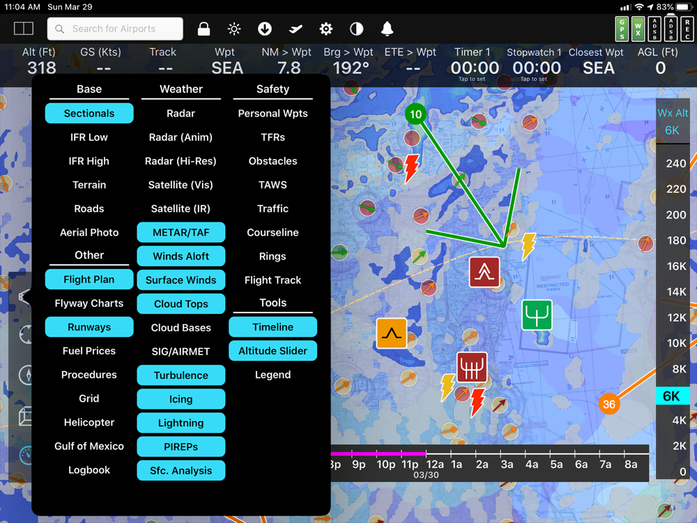
The Global Digital Map shows airports, airways, airspace, navaids, and waypoints from all around the world. Text rotates so it's always right-side up and the level of detail adapts to the zoom level.
Our exceptional "4D Predictive Weather" system uses a Timeline and Altitude Slider to help you analyze weather at different times - both past and future - and at different altitudes. 17 weather layers from both the Internet and ADS-B (e.g. Radar, Icing, Turbulence, PIREPs, Winds Aloft, Surface Winds, Surface Analysis, Satellite, and more), many tied to the Timeline and Altitude Slider, give you unprecedented pre-flight and in-flight safety.
Supports more than 20 ADS-B and in-panel devices: Stratus 3, Avidyne, Dynon, Stratux, and more.
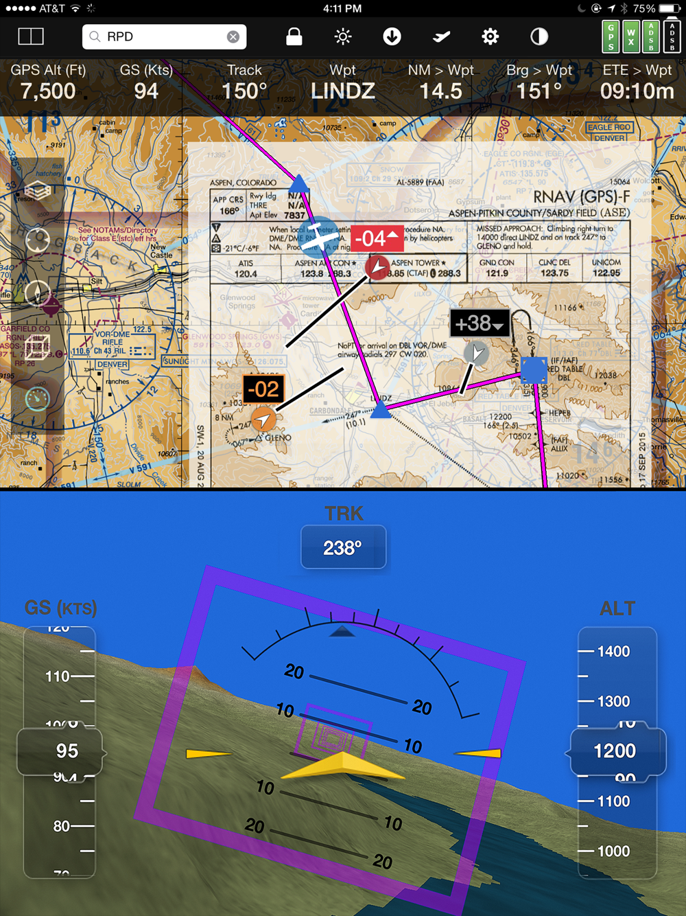
The exclusive Augmented Reality (AR) feature provides situational awareness you'd previously only seen in sci-fi movies.
The Slingshot wireless ChartData system means FlyQ supplies maps, plates, and apt diagrams wirelessly to certified systems from BendixKing.
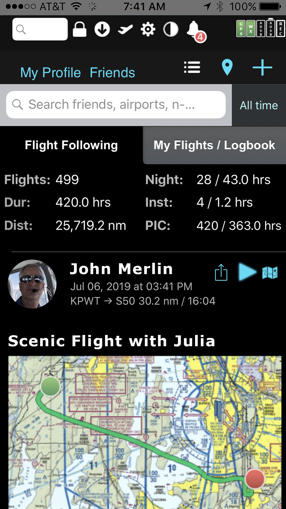
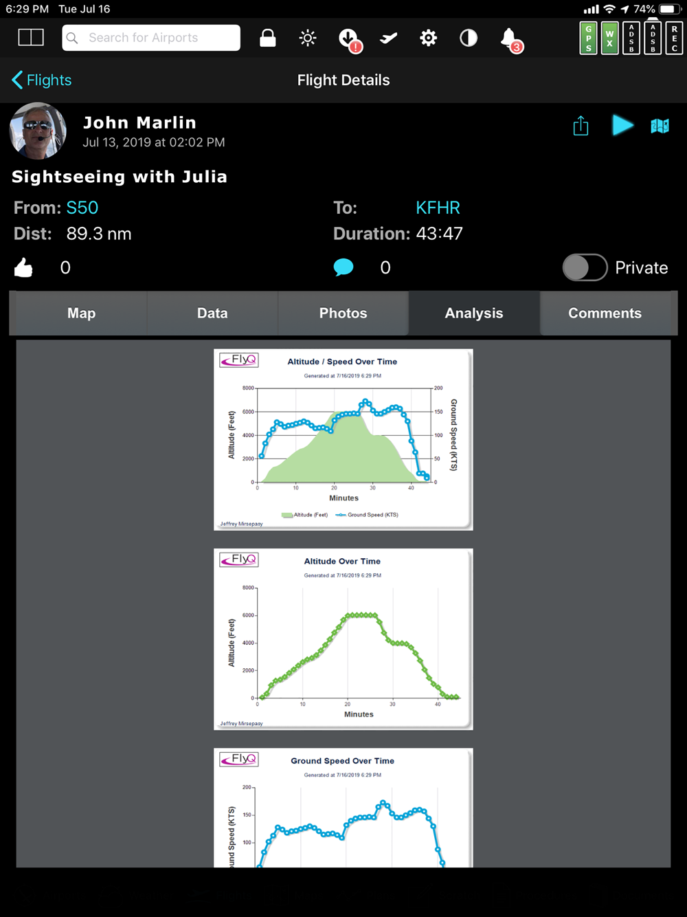
The Visual Logbook and Post Flight Playback / Analysis Graphs add a whole new dimension to your flying. Optionally connect with your friends to "see" and even replay their flights. CFI's can track student progress and remotely send endorsements.
Other key features include split screen, 3D synthetic vision, plates on the map, more than 4,600 airport diagrams, rich Documents support, extended runways, distance measurement, fuel prices, NOTAMS, wind-optimized flight planning, and plates for Mexico and Central America.
> Maps Your Way
+ Digital, 2D maps, 3D Syn Vis, Augmented Reality
+ Sectionals and IFR charts
+ Photo, road, terrain maps
+ 17 Weather Layers
+ Flight Track
+ Fuel Prices
+ TFRs
+ Obstacle and Terrain Avoidance
+ ADS-B Traffic and Weather
+ Extended runways with right-pattern indicators
+ Procedures on map
+ Rings / Extended Course Line
+ CAP grid
+ Heli and Gulf of Mexico charts
+ VFR Flyways
+ Syn Vis includes HITS boxes, EFIS display, TAWS, Obstacles, and AHRS support.
Night Mode preserves your night vision.
Split screen (iPad only) and single screen.
> Procedures
FlyQ includes the same Seattle Avionics geo-referenced approach plates and apt diagrams that we supply to certified avionics from BendixKing and Aspen. Split screen can show a map and a procedure simultaneously. Swipe to switch procedures or tap to list all procedures at an airport. Overlay procedures on a map. Annotate plates and diagrams with colored lines and text.
> Flight Planning that Saves Time and Money
1. Automatically uses recently cleared ATC routes (IFR only)
2. Automatically plans fuel stops based on lowest cost and uses expected winds to plot the fastest course, saving time and money on every flight.
3. CAP/SAR patterns
4. Exchange flight plans with Dynon SkyView, Avidyne, and Aspen.
5. Practice with X-Plane or MS Flight Sim / Prepar3D
> Weather
Amazing "4D Predictive Weather" uses a Timeline and Altitude slider to make detailed pre-flight and in-flight analysis easy. The Graphical Wind Optimizer uses red and green bars to show the headwind or tailwind at different altitudes. Also includes an extensive gallery of weather images.
> Airport Information
The Airport screen concisely shows key operational info, sat images, and runway diagrams on a single screen. weather, approach procedures, A/FD, and FBO info are just a tap away. Includes more than 4,600 SA Airport Diagrams.
> Data Manager
FlyQ makes it painless to download new data every month: spin and zoom a 3D globe to visually select the states you need.
> Try it before you buy it
Experience everything FlyQ EFB offers with a free 30-day subscription.
 it
it
 English
 Español
 Русский
 Deutsch
 Français
 العربية
 Italiano
 Türkçe
 Polski
 Português
 Indonesia
 日本語
日本語