GPS Marine Charts App offers access to charts covering Malta waters (derived from MMA(Malta Maritime Authority) data). Only marine GPS app to have route assistance with Voice Prompts for marine navigation. It has route manager to create new boating routes or import existing GPX/KML routes. It supports Nautical Charts course up orientation.
Please visit
http://www.gpsnauticalcharts.com/main/malta/all-all-malta-charts-nautical-charts-folio.html for
complete list. If you don't find the chart for Malta , please contact us at support at gpsnauticalcharts.com.
* Voice Prompts for marine navigation (requires GPS )
-prompts when approaching a boating route marker
-Continous distance and ETA updates
-Alerts when sailing/boating off route
-Alerts when boating in wrong direction
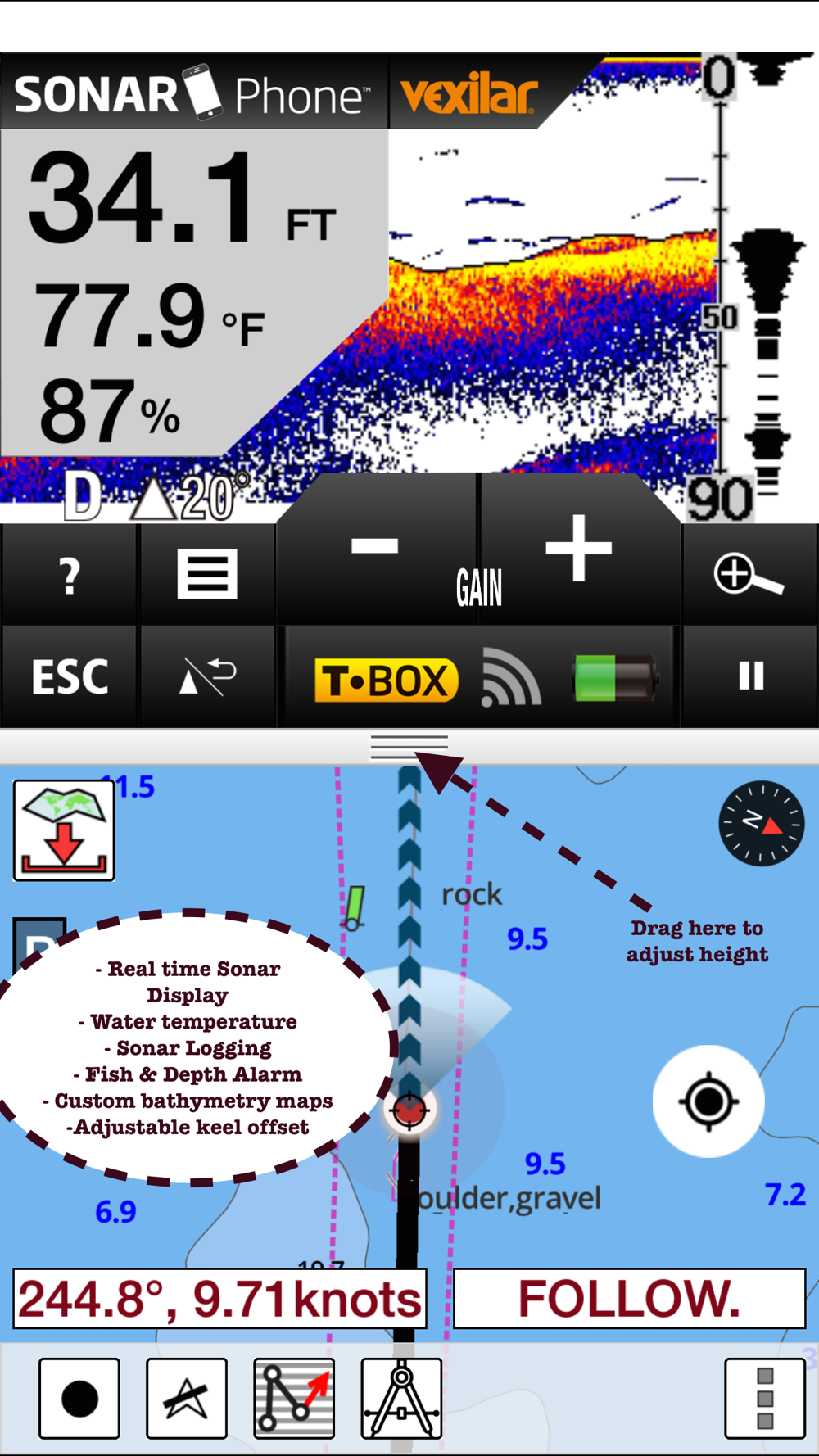
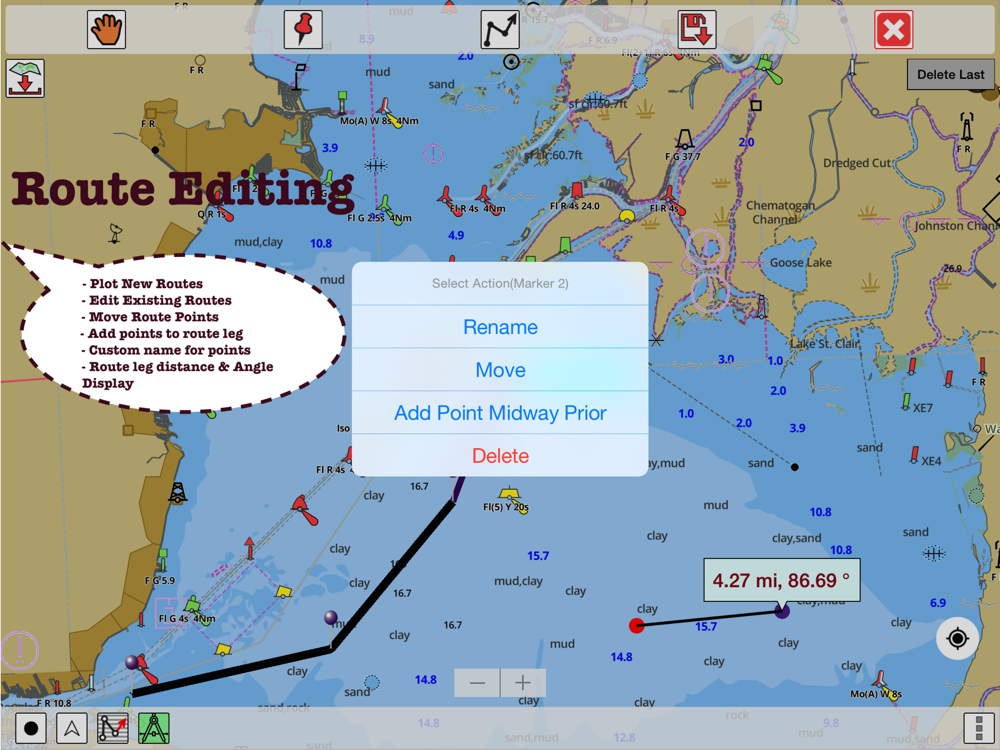
*Route Editing/Creation
-Create routes from scratch
-Edit existing GPX/KML routes.
-Add custom description to any route point.
-Drop markers along route.
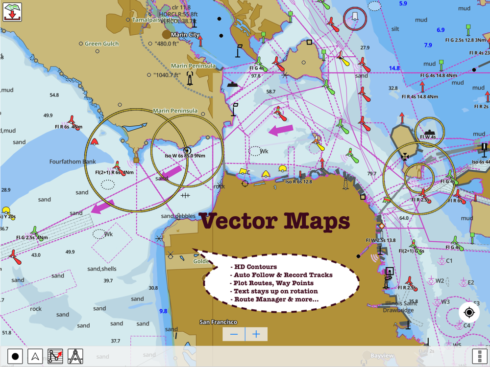
* Offline charts derived from UKHO data.
-Visually draw area to download
-Textual search
-Catalog (By state, region and coast guard district)
-Charts reprojected for WGS84 datum
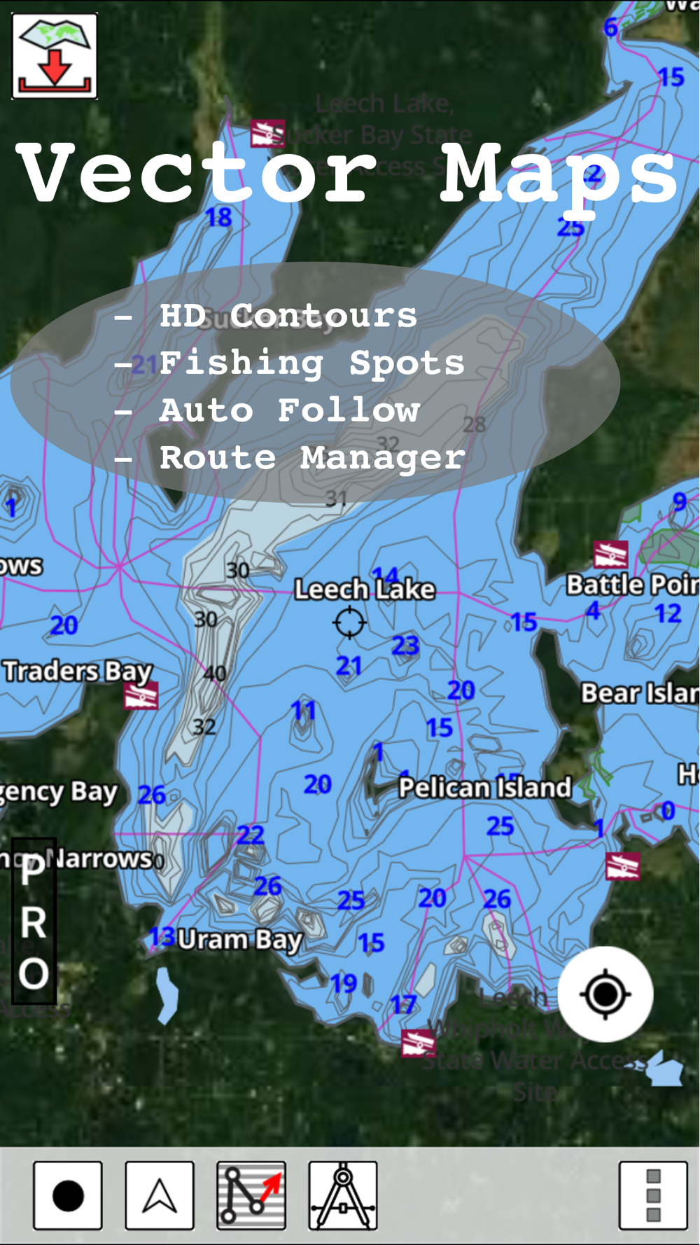
*Seamless chart quilting of marine charts
*Distance Bearing tool
*Create custom way points
- Using GPS
-Select point on map
-Manually enter latitude & longitude coordinates
*POI layer for marine charts
- Overlay POIs
- POI list derived from the equivalent ENC and contains all categories including Buoy, Light, Harbour facility, Obstr.
*Search POIs/Way points
*Pan/Zoom/My Location
* Record Marine GPS tracks
* View tracks overlay
* Live track animation
* Track analytics/stats
* Export GPX tracks.
-Export to SDCard
-Share GPX trakcs with friends.
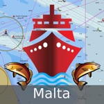
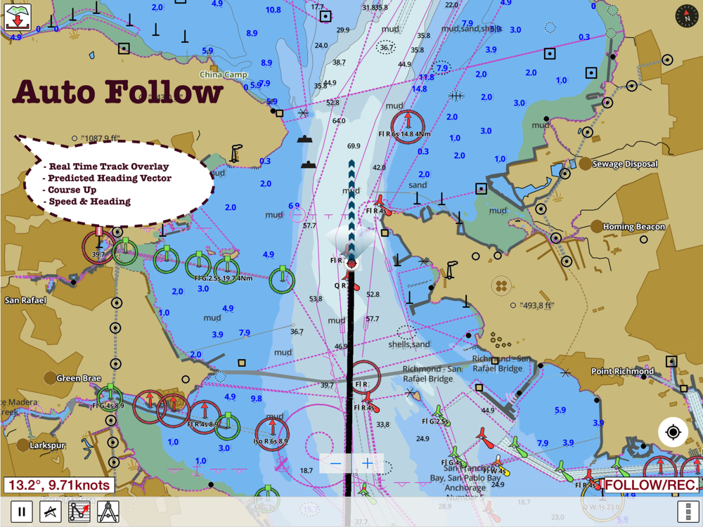
* Auto Follow Mode (Course up)
-Continuously updates boat's location on chart
- Adjustable update frequency
Sample Nautical Charts (please visit http://www.gpsnauticalcharts.com/ for complete list)
A - Channels between Malta and Ghawdex
Approaches to Malta and Ghawdex (Gozo)
B Il-Bajja ta' San Pawl
C- Il-Bajja tad-Dwejra
D Il-Port ta' L-Imgarr
E Il-Bajja Ta' Marsalforn
F - Il-Bajja tax-Xlendi
Ghawdex (Gozo)- Kemmuna (Comino) and the Northern Part of Malta
Malta
Marsaxlokk
Valletta Harbours
PLEASE NOTE: Continued use of GPS running in the background can dramatically decrease battery life.
 id
id
 English
 Español
 Русский
 Deutsch
 Français
 العربية
 Italiano
 Türkçe
 Polski
 Português
 Indonesia
 日本語
日本語