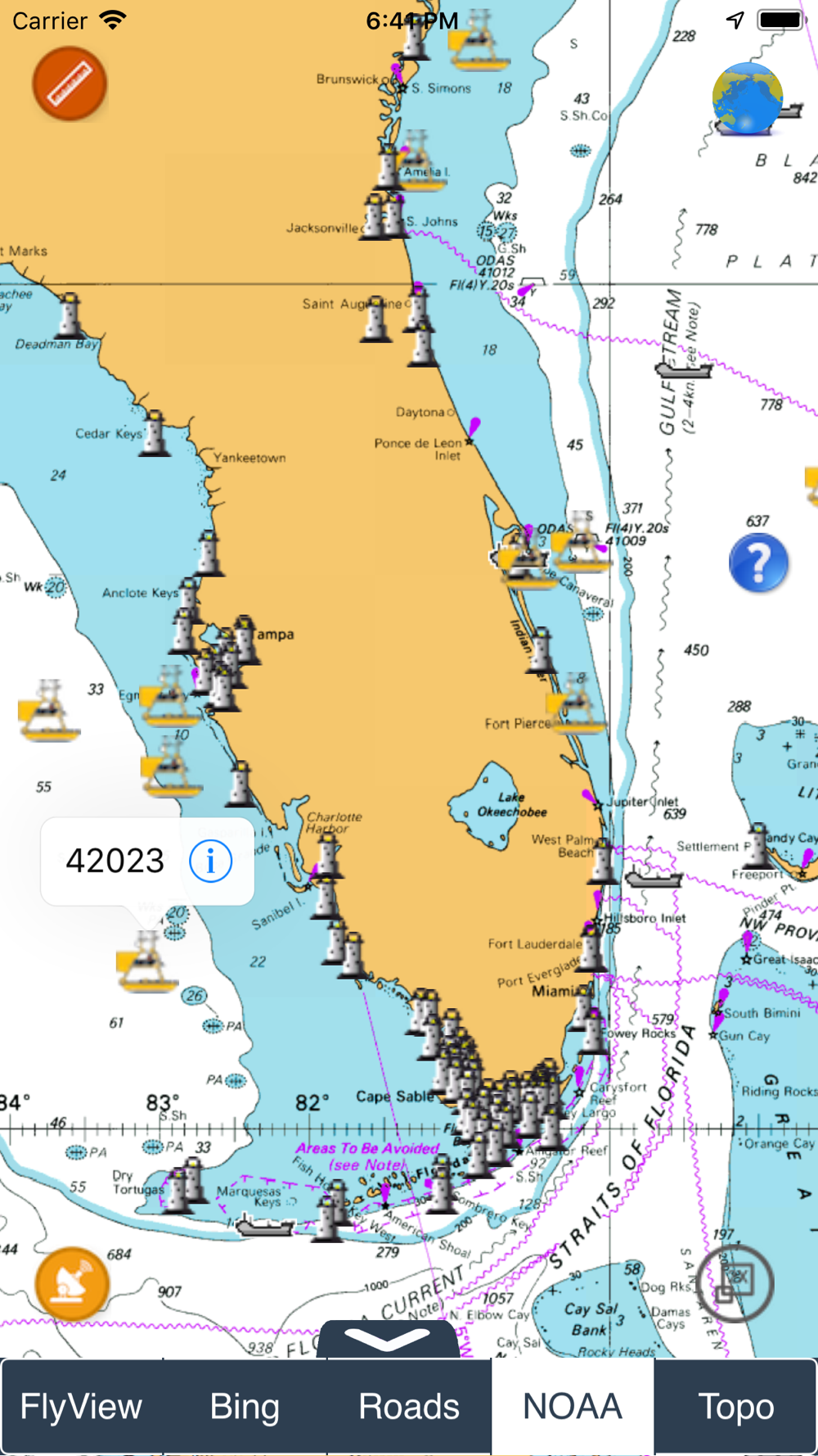
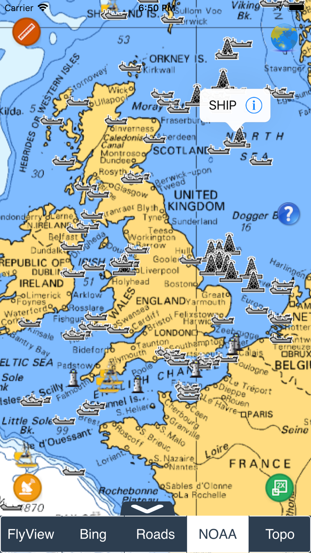
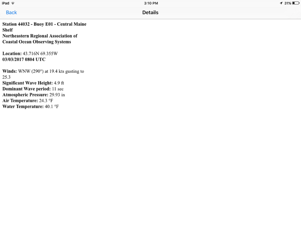
NOAA Buoy data viewer allows you to retrieve info like tides, wave height and period, wind speed and direction, air and water temperature, humidity, dew point, atmospheric pressure, rising and falling indicator, visibility, tsunami and typhoon warnings on detailed marine chart thanks to viewer.flytomap.com
All stations, buoys and ships are drawn on the world marine map, you can easily search the nearest stations and retrieve all NOAA info.
Just tap and get the info you require.
Advise and info are coming directly from NOAA's National Data Buoy Center.
A must for boaters, sailors, anglers and divers.
Detailed Features:
* View buoys near you
* Use GPS or manually enter your choosen location on a very detailed Marine Map.
* Works on all iPhone, iPod, and iPad versions.
* Detailed live buoy data with access to location specific forecasts.
* Buoys sorted by proximity to your selected location.
* Tide Predictions.
* Moon phases.
**For all buoy locations available on the NOAA BUOY app, check: http://www.ndbc.noaa.gov/
 en
en
 English
 Español
 Русский
 Deutsch
 Français
 العربية
 Italiano
 Türkçe
 Polski
 Português
 Indonesia
 日本語
日本語