HAZMAT Evac provides First Responders and Emergency Managers easy access to map-based improvised explosive device (IED) standoff distances and HAZMAT spill evacuation areas. The IED standoff data is based on criteria set by the DHS Office for Bombing Prevention and FEMA 426, Reference Manual to Mitigate Potential Terrorist Attacks Against Buildings. Hazmat evacuation and reference data is based on the 2012 Emergency Response Guidebook (ERG). Users are able to define custom IED types and standoff values. Access to DHS IED standoff data requires a statement of need by those not registering with a .mil, .gov, or .us email address accounts.
Features of the software include:
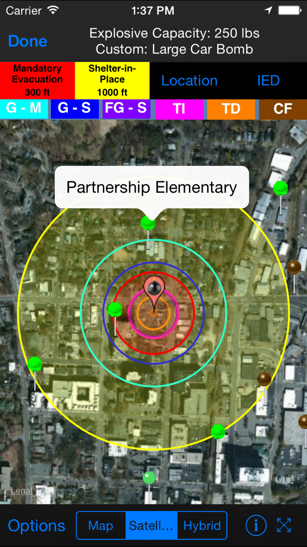
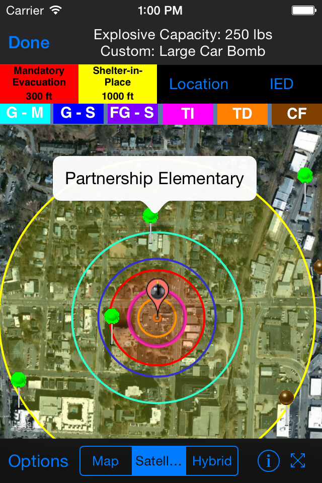
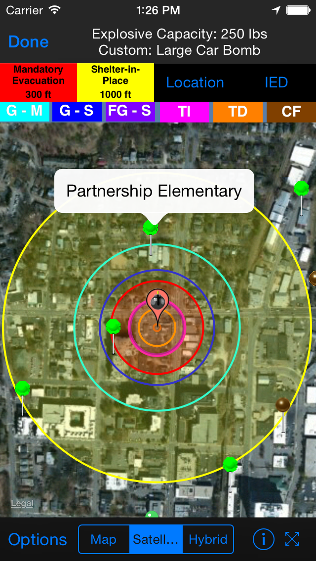
•Display IED Mandatory Evacuation and Shelter-in-Place Zones for 8 pre-defined bomb sizes
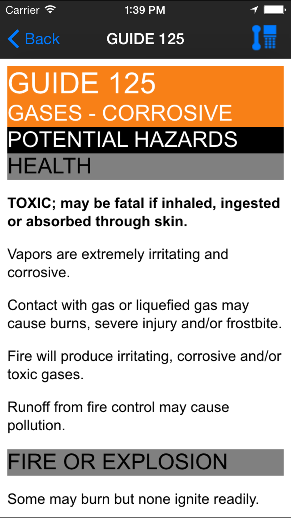
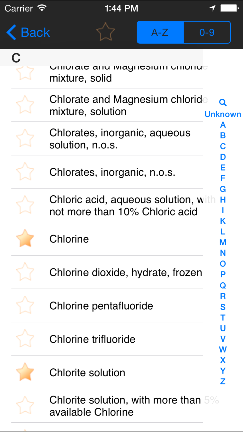
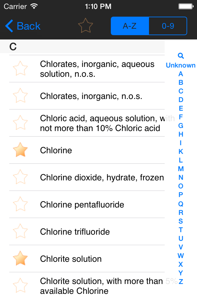
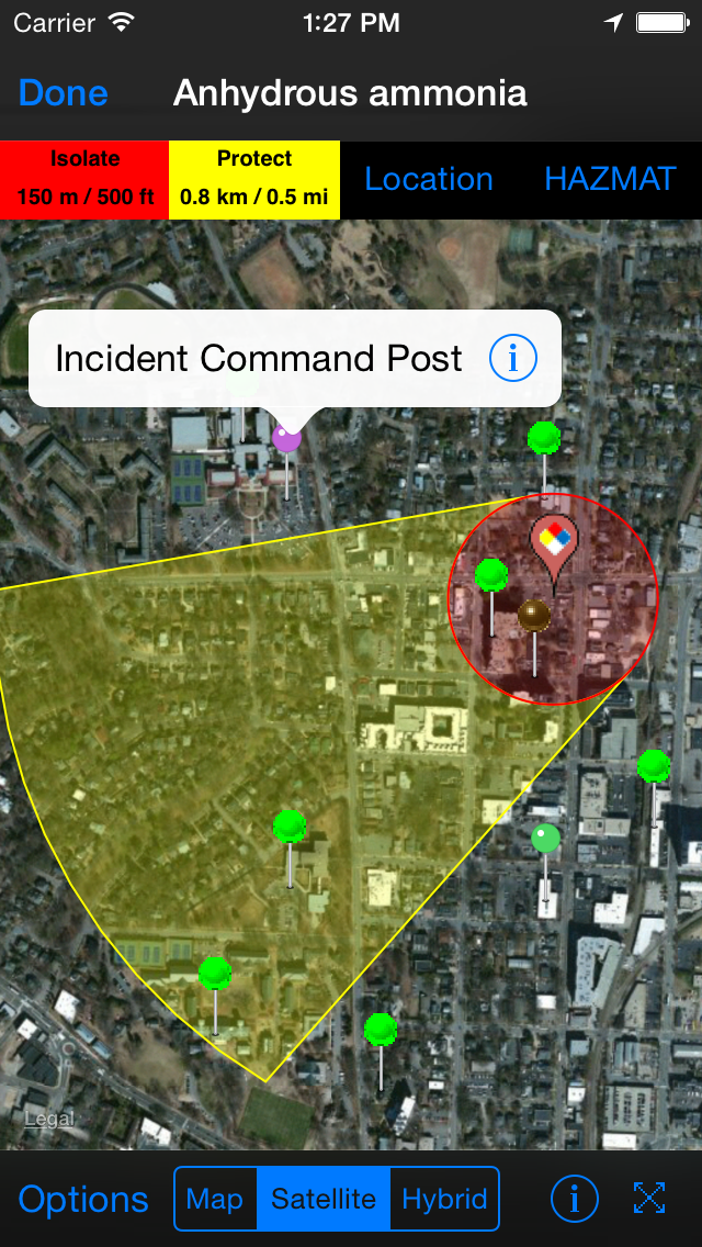
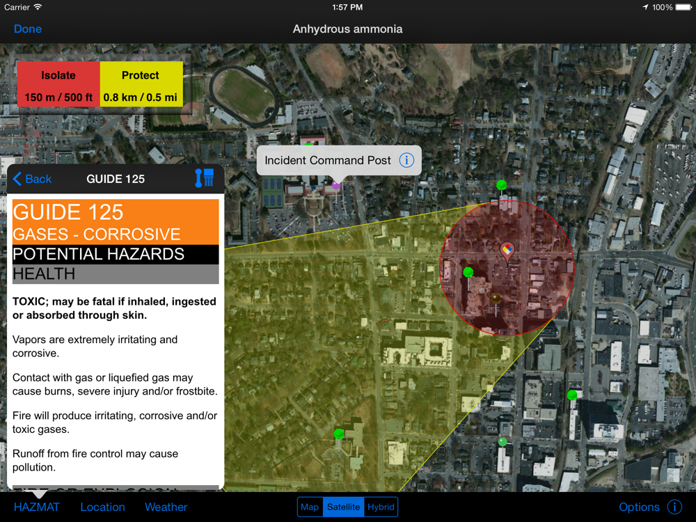
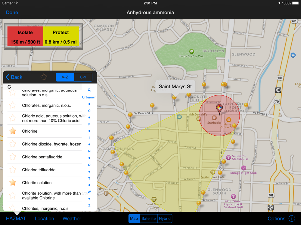
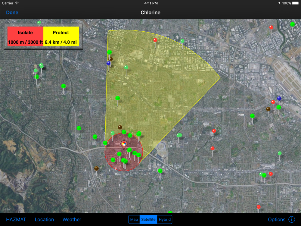
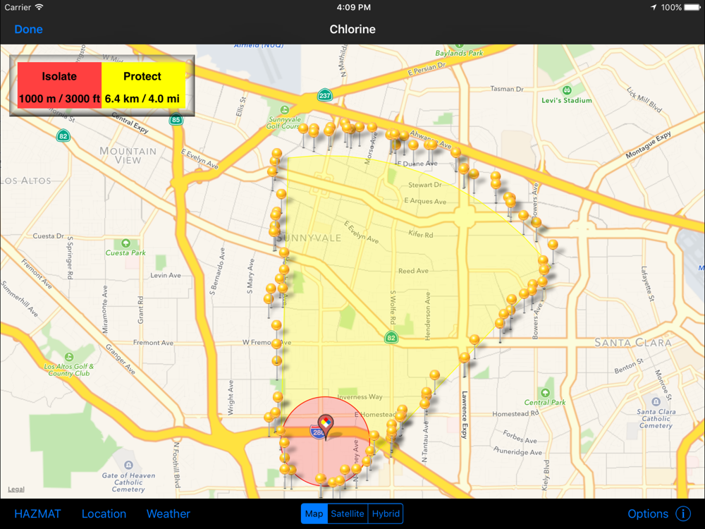
•Display Isolation Zones and down-wind Protection Zones for over 3,000 chemicals
•Display distance to glass breakage, injury, and structural damage based on pre-defined bomb sizes (limited to users registering with a .gov, .mil, or .us email)
•Information displayed on phone maps, with similar functionality to zoom, search by address, current location, and map/satellite/hybrid views
•Automatically retrieve current weather from Weatherbug (www.weather.weatherbug.com) or forecast weather from the National Weather Service (US only) or Meteorologisk Institutt (Worldwide); weather can also be user input or input using the phone’s compass functionality
•Results shown geographically as well as text based
•Search and display predefined points of interest (schools, nurseries, hospitals, police/fire stations, and government facilities) from GIS search services to identify key facilities within the incident area
•Run roadblock analysis service that identifies within seconds the optimal location of roadblocks to isolate the incident area
•Place and label points on the map to identify key locations
•One-button summary of results (text, map image, map data shape and kml file attachments) in an email to disseminate to other responding personnel
•Includes reference material from the 2012 ERG and important chemical contacts for quick calling
•Store map images (including legends) for reference when connectivity prevents access to network maps
For more information, go to www.firstsupporttools.com
 en
en
 English
 Español
 Русский
 Deutsch
 Français
 العربية
 Italiano
 Türkçe
 Polski
 Português
 Indonesia
 日本語
日本語