Download for a 30-day free trial. ForeFlight is the essential, integrated flight app that makes planning, flying, and logging flights a joy.
ForeFlight delivers advanced flight planning capabilities, terminal procedure charts, enroute navigation charts, moving map, synthetic vision, hazard awareness, optional Jeppesen charts, a comprehensive library of market-leading weather information and visualization features, a large library of advanced aircraft performance profiles, customizable checklists, integration with a wide range of certified avionics and portable ADS-B and GPS receivers for inflight weather and data, a built-in documents catalog and cloud document capability for management of aircraft and flight operations publications, an easy-to-use pilot logbook for keeping track of flight experience, and so much more. ForeFlight is backed by our Pilot Support Team who delivers amazingly fast, accurate, and friendly customer service.
Please note: Location is used to enable a moving map and to record track logs, the camera is used to attach photos to logbook, push notifications are used for important bulletins and flight alerts, and contacts are used to add people to flights.
ForeFlight requires a subscription. Visit our website for more information on the available plan levels.
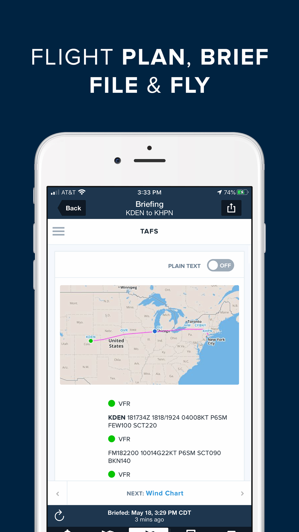
FLIGHT PLANNING, BRIEFING, & FILING
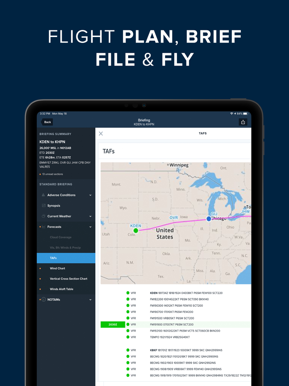
Plan flights with Touch Planning on the Map or full-featured form-based Flights view. Tap out a route in seconds and quickly see if flights will be affected by weather or TFRs. Helpful Route, Altitude, and Procedure Advisors make planning easy and accurate. Generate a graphical preflight briefing and file your flight plan directly from the app. Print a professional-grade Navlog for inflight reference.
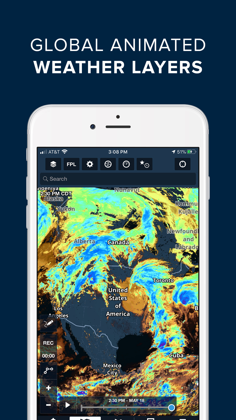
WEATHER
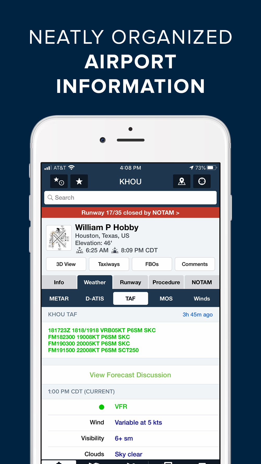
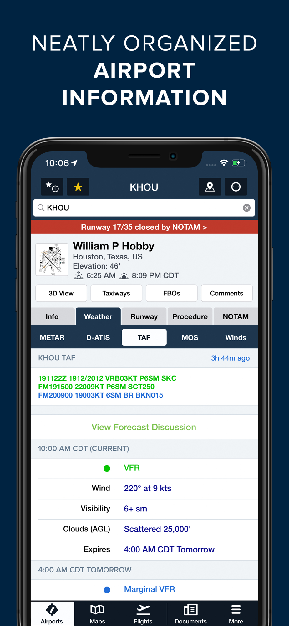
Interactive weather layers include animated radar, global satellite and winds aloft, global icing, turbulence, and surface analysis, graphical AIR/SIGMETs, flight category, visibility, and more. View decoded METARs, TAFs, and MOS forecasts. Thoughtfully organized Imagery view puts a full range of forecast tools at your fingertips.
PLATES, CHARTS, & MAPS
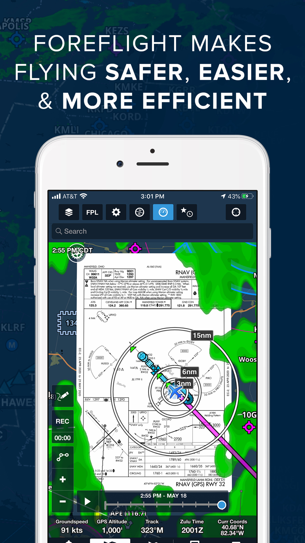
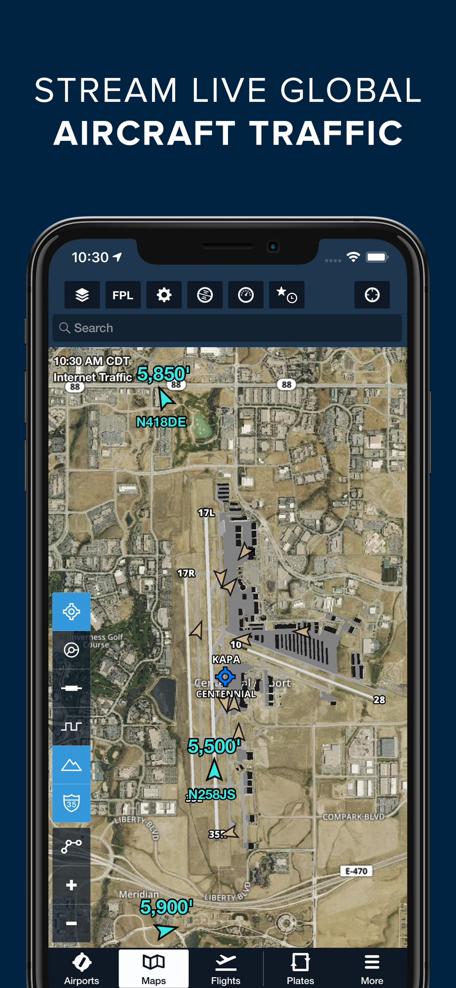
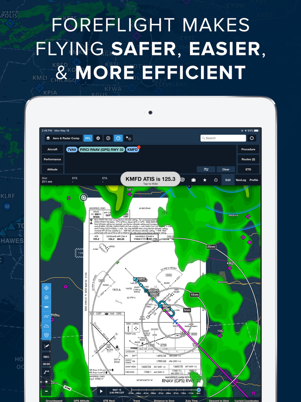
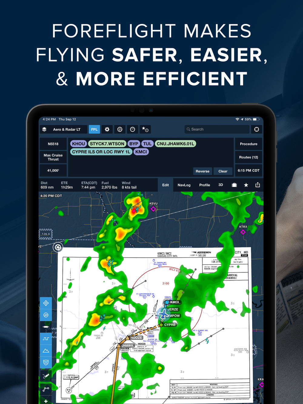
Both VFR and IFR operations are covered with all of the essentials required for planning and navigation: data-driven Aeronautical Maps, VFR Sectionals, High/Low Enroute charts, SIDs, STARs, approach and taxi charts, and terrain, satellite, and street map views.
GEO-REFERENCED APPROACHES & TAXI CHARTS
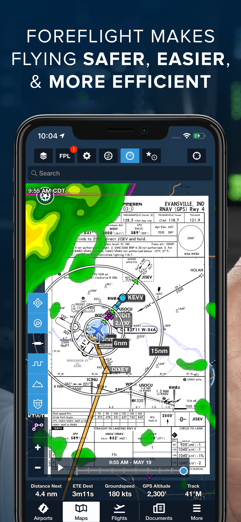
Plates and taxi charts enable the real time display of your GPS location on the chart. They can also be overlaid on the Maps view along with weather and hazards for the ultimate situational awareness.
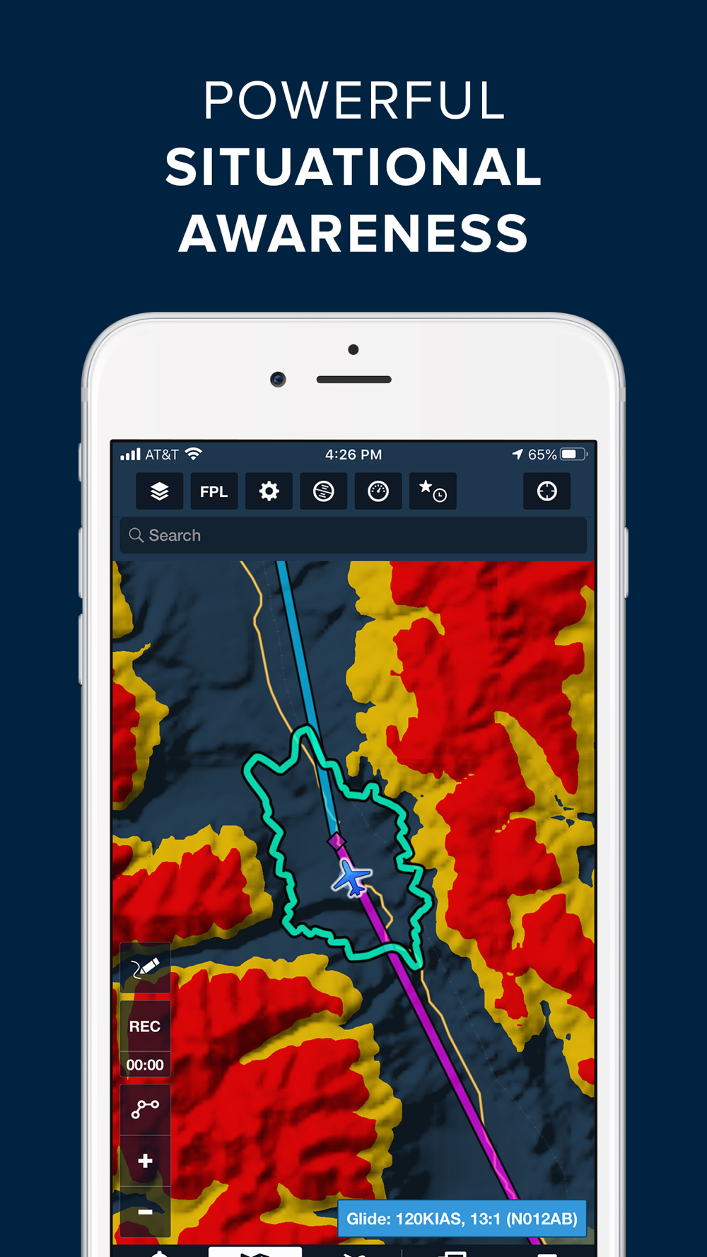
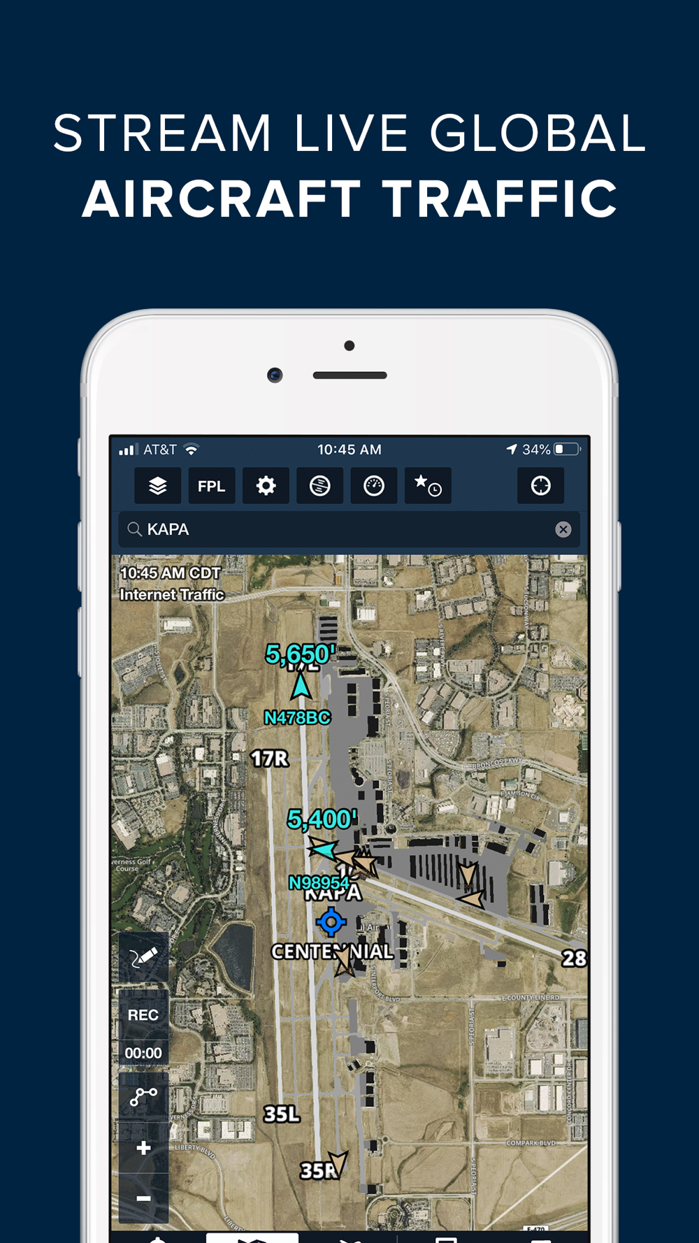
GLOBAL HAZARD AWARENESS TECHNOLOGY
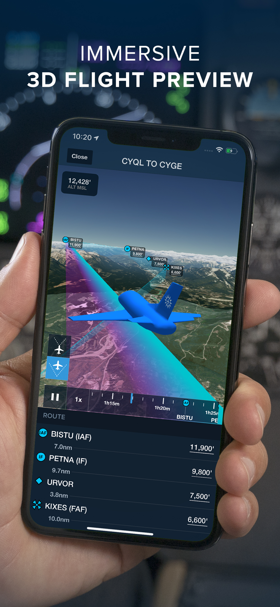
Plan and fly with more confidence in all conditions and terrain. Top-down-view Hazard Advisor map layer, Terrain Profile View, and 3D Synthetic Vision seamlessly integrate into the map display to depict a clear picture of terrain and obstacle hazards anywhere in the world. When paired with an AHRS source, Synthetic Vision provides a backup attitude display.
LOGBOOK
Logbook makes it easy to log and share flights, track hours, review currency, record certificates and ratings, receive electronic instructor endorsements, and create experience reports. Your data is automatically synced across all your devices and protected in secure cloud storage.
ADDITIONAL FEATURES INCLUDE:
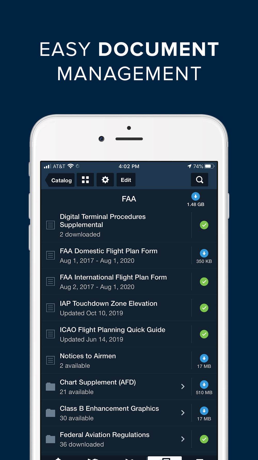
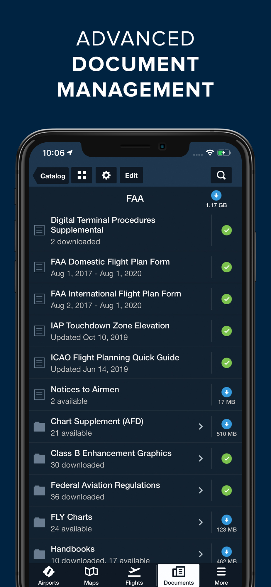
Built-in documents catalog with FAR/AIM, charts supplements, and more
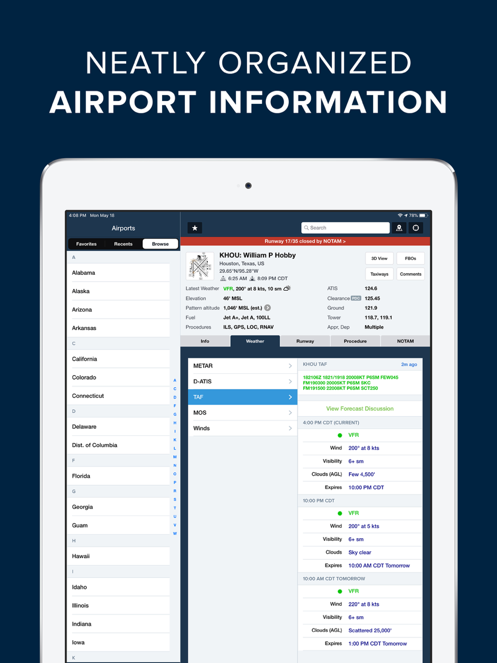
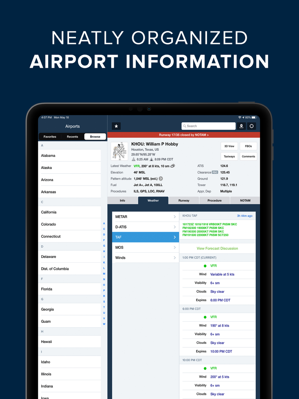
Airport, FBO, and fuel price information for thousands of locations
Dynamic data-driven Aeronautical Maps
Weight & Balance
Glide Advisor
Expected route and EDCT flight notifications
Automatic over-the-air data updates
Chart color inversion for better night flying experience
Access to web planner
REVIEWS
Flying Magazine Editor's Choice 2012, 2013, 2014, 2017
App of the Year, Aviation Consumer, July 2011
Best Selling iPad Aviation App: 2010, 2011, 2012
"Best app for IFR" - Aviation Consumer
"One of the most popular and most-respected aviation apps available" - Sporty's Pilot Shop
 en
en
 English
 Español
 Русский
 Deutsch
 Français
 العربية
 Italiano
 Türkçe
 Polski
 Português
 Indonesia
 日本語
日本語