Topographic map of New Zealand with no limitations:
• View topographic tiles and satellite imagery
• Viewed tiles cached automatically (for offline availability)
• Add unlimited map markers
• Show your location and distance to markers
• Import / export GPS Exchange Format (GPX) waypoints from iCloud Drive
• Search for places of interest (supports decimal coordinates)
• Navigate with Google Maps interactions (pinch zoom, scroll, rotate, drop marker, drag marker etc)
• Battery conscious (for those that can't recharge every day)
• Fully functional for free! (no lite or pro versions required)
New Zealand (NZ) Topo Map is intended for outdoor enthusiasts who want to mark locations visited or create markers to visit. It does not provide track information, show track routes, record while walking, show speed etc. It's designed to be lightweight, intuitive, responsive, battery conscious and totally free. Perfect for casual day trips to serious bush excursions.
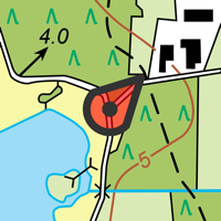
Topographic Map Tiles
The Topo50 map series provides topographic mapping for the New Zealand mainland and Chatham Islands at 1:50,000 scale.
At a scale of 1:50,000, Topo50 maps show geographic features in detail. They are useful for a wide range of activities such as local navigation by vehicle or on foot, locality area planning and study of the environment. Used by a wide variety of groups, Topo50 is the official topographic map series used by New Zealand emergency services.
To produce our Topo50 maps of the New Zealand mainland we use:
• The New Zealand Geodetic Datum 2000 (NZGD2000) – the coordinates of longitude and latitude
• The New Zealand Transverse Mercator 2000 (NZTM2000) projection – this is what enables the curved mathematical surface approximating the Earth to be represented on a flat sheet of paper.
To produce our Topo50 maps of the Chatham Islands we use the Chatham Islands Transverse Mercator 2000 (CITM2000) projection.
Topo50 map tiles sourced from the LINZ Data Service http://data.linz.govt.nz/ and licensed by LINZ for re-use under the Creative Commons Attribution 3.0 New Zealand licence.
Satellite Imagery
LINZ has been working towards getting New Zealand’s most current publicly-owned aerial imagery – covering 95% of the country.
Aerial imagery is captured from airborne sensors and cameras. It provides an accurate photographic representation of the earth’s surface and the features on it. It can be used to visualise landscape, or to understand how an area has evolved over time.
Sourced from the LINZ Data Service and licensed for re-use under the Creative Commons Attribution 3.0 New Zealand licence (http://www.linz.govt.nz/data/licensing-and-using-data/attributing-aerial-imagery-data)
 en
en
 English
 Español
 Русский
 Deutsch
 Français
 العربية
 Italiano
 Türkçe
 Polski
 Português
 Indonesia
 日本語
日本語