Current and valid FAA&AISWEB aviation charts updated every 28 days, including approach plates! Includes basic international airport data from ourairports.net and openAIP.net.
Due to no freely avialable charts, please note that for charts outside of USA&Brazil non current ONC/VFR with a current openAIP overlay is available, but NO IFR charts or plates are available.
Includes a free 30 day trial!
If you wish to continue using SkyCharts after the trial, please purchase a $3.99/month subscription. Note that buying a subscription does not unlock any additional features.
See full description regarding auto-renewing subscriptions, privacy policy and EULA below.
For USA/Alaska, the application has all current FAA VFR (sectional+WAC), IFR (High and Low), TAC, FLY (flip side of TAC chart), Helicopter, Gulf Coast WAC, Gulf Of Mexico, and Wall aviation charts.
Grand Canyon charts are included in the TAC charts, and Bahamas and Mexico as WAC charts.
Brazil has VFR, IFR (High and Low) and approach plates.
Also included is a METAR/TAF overlay, and an IFR overlay to view routes on top of VFR charts.
Its very easy to create and modify routes directly on the map or by drag&drop in table.
Navigation readout is configurable to fit exactly what you want to see. It also has a nifty auto-layout feature that selects fields for you in both portrait and landscape mode.
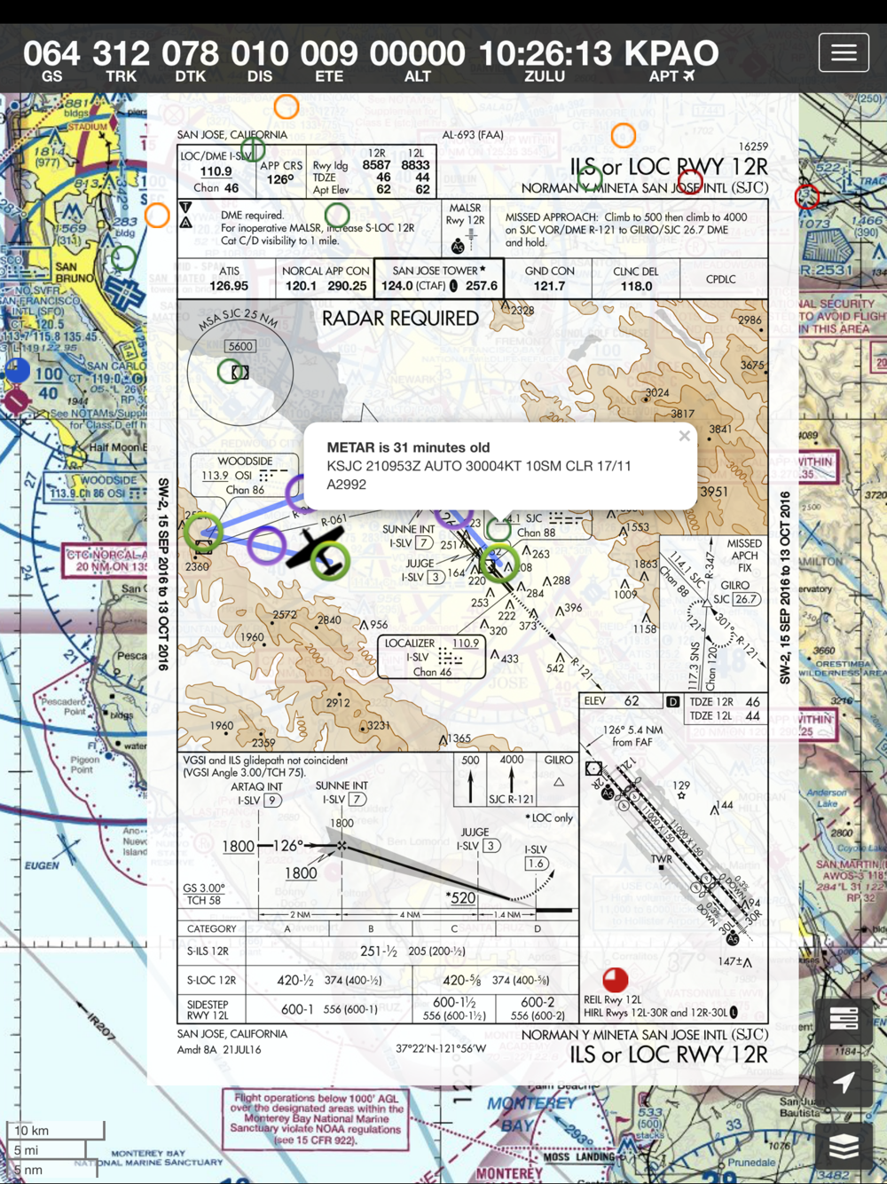
DOUBLE TAP on map to view A/FD and approach plates.
Map has VFR/IFR/LIFR color-coded weather METARs, with orange TAFs.
SUA (Special Use Airspace) information is also available.
Download charts and plates for offline usage.
Features:
* Fast zoom/scroll of included charts using standard gestures.
* Allows download of charts for offline usage. Charts are selected on a region basis.
* Navigation computes GS, TRK, DTK, DIS & ETE to final waypoint.
* METAR/TAF color coded dots according to ADDS: http://www.skycharts.net/?page_id=421
* Double tap on airport to select A/FD and TPPs/IAPs to view.
* Huge built-in navigation database, with all 20,000 airports, 45,000 FAA IFR/VFR navigation fixes and 2,100 FAA VOR/ADF fixes.
For more information, please see the webpage at
http://www.skycharts.net
The monthly subscription of SkyCharts XC aviation data of $3.99 is auto-renewed. Payment will be charged to your iTunes/App Store account at confirmation of purchase. You can turn off auto-renew at any time from your iTunes/App Store account settings, but you must do so at least 24 hours before the end of the current subscription period to avoid being billed for the next cycle. No cancellation of the current subscription is allowed during the active period. Any unused portion of a free trial period will be forfeited when you purchase a subscription to SkyCharts XC.
The privacy policy and EULA can be found here:
http://www.skycharts.net/?page_id=1465
For fast response to all questions, comments or suggestions, please email
[email protected] en
en
 Español
 Русский
 Deutsch
 Français
 العربية
 Italiano
 Türkçe
 Polski
 Português
 Indonesia
 日本語
日本語