The Rundumadum app is intended to provide an overview of the Vienna Rundumadum hiking trail. It should serve to plan a hike and the individual stages, as well as for navigation during the hike.
Various types of maps are available for easier navigation, including topological maps with altitude information and satellite maps.
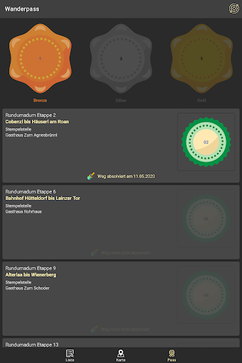
There is a digital hiking pass in the app. Collected stamps can be entered in the hiking pass for completed hiking trails. From a certain number of stamps collected, you get hiking badges in bronze, silver and gold.
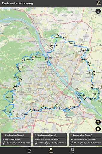
The Rundumadumweg stretches for 120 kilometers around the city of Vienna. There are a total of 24 easy stages between 3 and 10 kilometers, all of which are easily accessible by public transport.
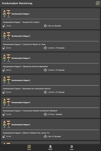
Stage 1 - Nussdorf to Cobenzl
Stage 2 - Cobenzl to Häuserl am Roan
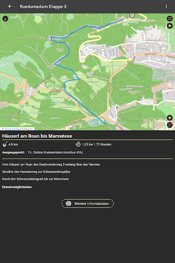
Section 3 - Häuserl am Roan to Marswiese
Stage 4 - Mars meadow to Steinhof fire station
Stage 5 - Steinhof fire station to Hütteldorf train station
Stage 6 - Bahnhof Hütteldorf to Lainzer Tor
Section 7 - Lainzer Tor to Breitenfurter Straße / Liesingbrücke
Section 8 - Breitenfurter Straße / Liesingbrücke to Alterlaa
Stage 9 - Alterlaa to Wienerberg
Stage 10 - Wienerberg to Laaer Wald
Section 11 - Laaer Wald to Zentralfriedhof
Section 12 - Central Cemetery to Neu Albern
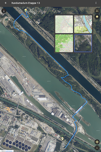
Stage 13 - Neu Albern to Waldschule Lobau
Stage 14 - Lobau forest school to Panozzalacke
Stage 15 - Panozzalacke to National Park Camp
Stage 16 - National Park Camp to Esslinger Furt
Stage 17 - Eßlinger Furt to Himmelteich
Section 18 - Himmelteich to Breitenleer Straße
Section 19 - Breitenleer Straße to Wagramer Straße
Section 20 - Wagramer Straße to Gerasdorf
Section 21 - Gerasdorf to Brünner Straße
Section 22 - Brünner Straße to Steinernes Kreuz
Stage 23 - Stone Cross to Strebersdorf
Stage 24 - Strebersdorf to Nussdorf
This app is a private, non-commercial project. The app is free and ad-free.
 en
en
 English
 Español
 Русский
 Deutsch
 Français
 العربية
 Italiano
 Türkçe
 Polski
 Português
 Indonesia
 日本語
日本語