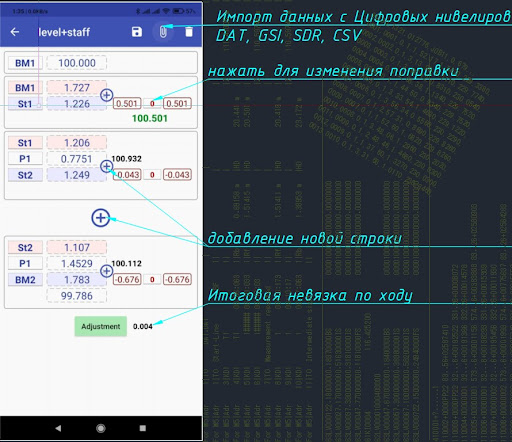
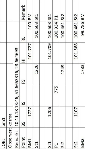
If you use this app, you need not have a field book.
- Quick adjustment with saving the result to a file (.csv)
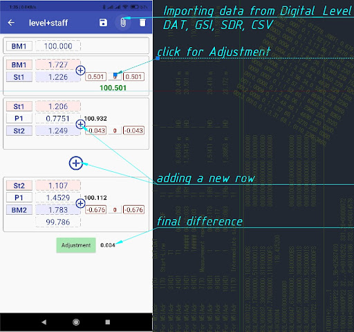
- Automatic and manual equalization adjustment.
- Import Digital Level (leica: GSI; Sokkia SDL: SDR; Trimble DiNi: DAT; CSV)
- Data is always saved when you turn it off.
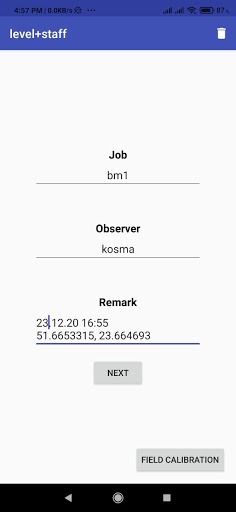
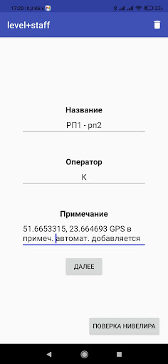
- In the notes, you can save the GPS coordinates of the project creation site.
- Deleting invalid rows (clicking on a row on the right(1 sec)
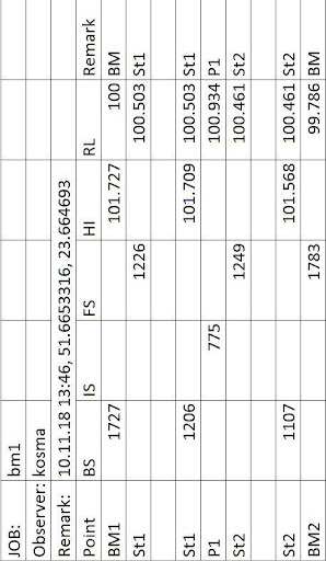
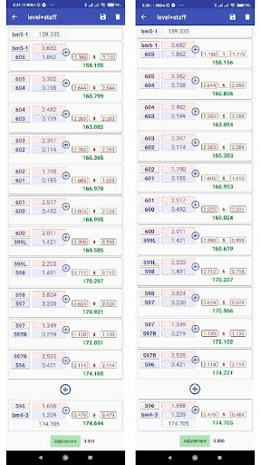
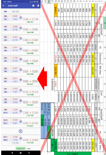
Displays a report of raw and adjusted elevations from the vertical adjustment methods. The line adjustment allows to spread the occurring difference over the individual staff stations.
It is also possible to adjust loops. Loops are leveling lines with identical start and end height.
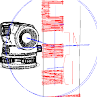
NB The staff should be ‘rocked’ back and forth, and the lowest reading recorded. Try to keep your back sights and fore sights of roughly equal length.
Auto level surveying calculation app: Implementation
https://youtu.be/4szdeGg3iNM
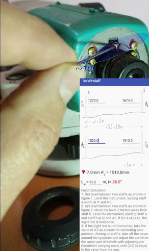
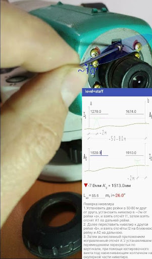
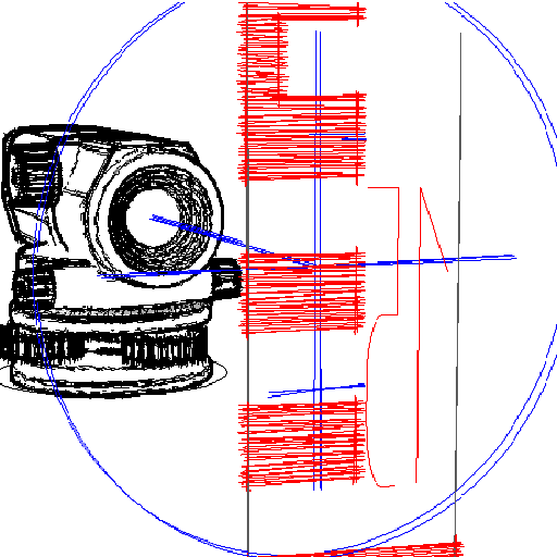
Collimation of the Instrument:
Initially, the input fields are empty, and initially we enter a value in the I1 field, input in other fields is not available until we enter in I1. With input to I1, input to A1 opens, etc. I.e. data inputs are allowed only in turn I1, A1, I2, A2.
After entering the last value, the calculation appears at the bottom of the screen.
It is simple: x=((I1 - I2)-(A1 - A2))/2= (( 1270 + 1910 ) - ( 1674 + 1520 ))/2= -7
Corrected count:
A2+ X=1520+(-7)=1513.
i - line of sight correction in ["]
Accuracy of recording and closure errors
All the measurements are done in metric and the value of the staff readings are rounded
off to the nearest millimeter for ordinary site surveys discussed in this manual.
The maximum permissible error for such a survey is normally taken as 20 K mm, where
K is the total distance leveled over in kilometers.
For instance, if the known difference in level between a B.M. No 1 and a B.M. No 2 is
2.876 m and the observed level difference from a level run with a length of 1.6 kilometers
is 2.869 TO, the error is 2.876 - 2.869 = 0.007 m or 7 mm.
The permissible error is calculated with 20 K = 20 1.6 = 25 mm, and the conclusion is
that the error Bade during the leveling is acceptable as it is smaller than 25 mm.
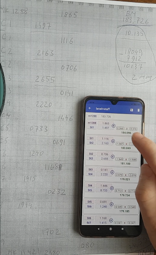
If we look at our example (see Fig. 6) we can estimate the length of the round trip at 100
+ 200 + 235 = 535 m, say 550 m. The permissible error becomes 20 0.55 = 14.8 mm.
Therefore the actual error of 6 mm is acceptable
 en
en
 English
 Español
 Русский
 Deutsch
 Français
 العربية
 Italiano
 Türkçe
 Polski
 Português
 Indonesia
 日本語
日本語