The SCATalogue app is a creation of the California Department of Fish and Wildlife, Office of Spill Prevention and Response (CDFW, OSPR).
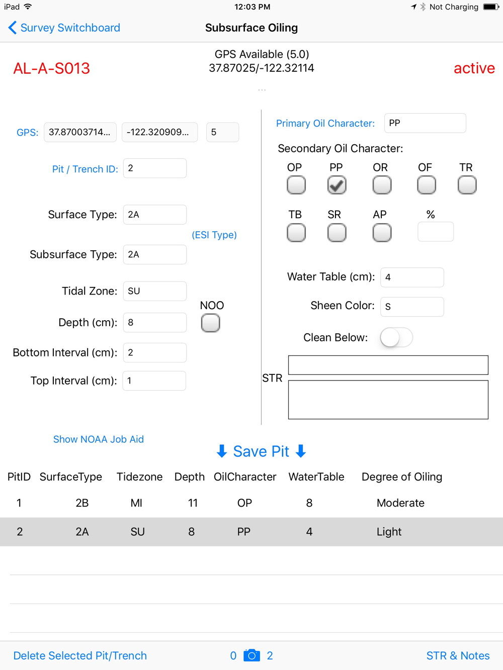
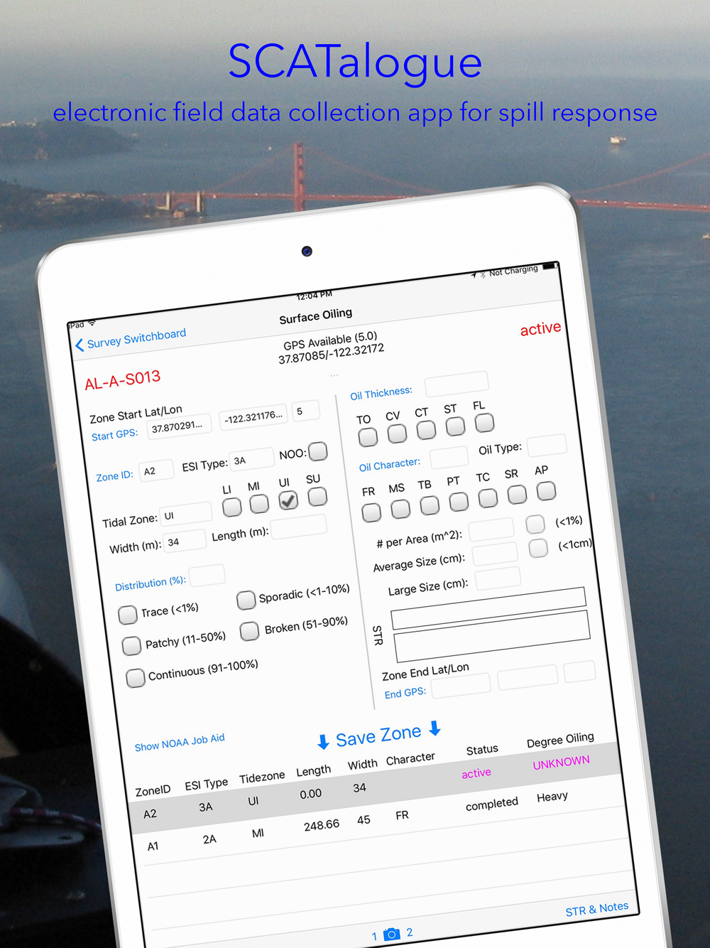
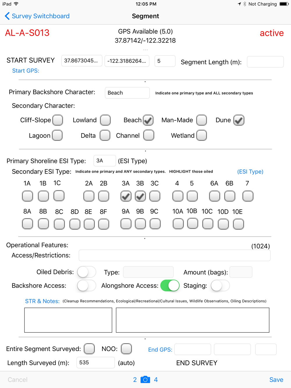
SCATalogue simplifies the collection of shoreline cleanup assessment technique (SCAT) data during a spill response. Survey data attributes are based upon the National Oceanic and Atmospheric Administration (NOAA) standard SCAT shoreline oiling summary (SOS) paper form. A SCAT survey is a collection of SCAT data for a length of shoreline which is referred to as a shoreline segment. SCATalogue is designed to support spill response in the marine environment.
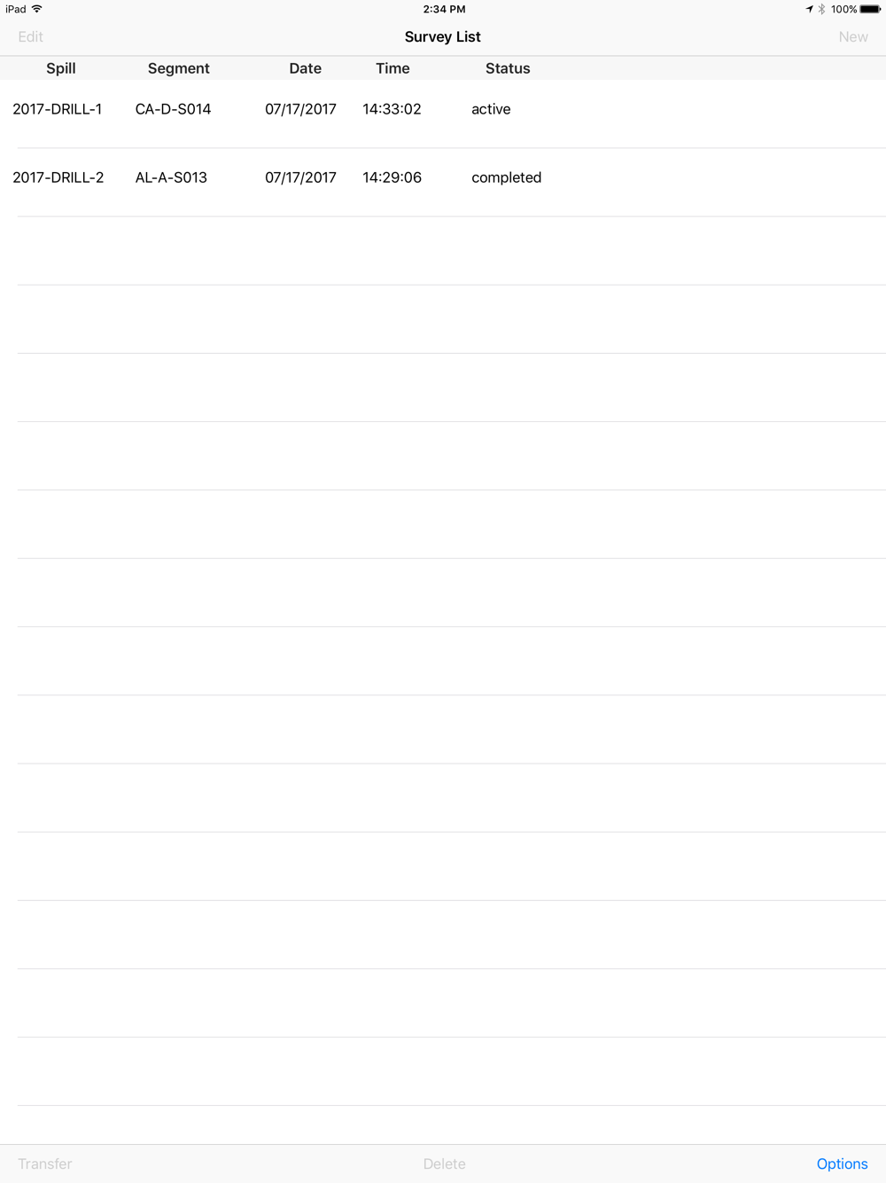
The survey data can be transferred via email, via iTunes or other methods if available. These other methods are dependent on the user's and/or user's organizational iPad setup and/or information technology (IT) protocols.
SCATalogue is, and was designed for use on an iPad, specifically the iPad mini which is used by the California Department of Fish and Wildlife, Office of Spill Prevention and Response's field response staff.
CDFW OSPR's geographic information systems (GIS) unit utilizes ESRI ® GIS software almost exclusively.
Data output is in JSON format. Data containing geographic/spatial data is formatted in Environmental Systems Research Institute (ESRI ®) geoJSON format. This output can be converted into to feature class(es) using ArcGIS Desktop's © ArcToolbox's "JSON To Feature" tool. CDFW OSPR GIS processes the JSON/geoJSON output from SCATalogue using this tool and other custom scripts/tools in ArcGIS Desktop © software.
For further information about SCATalogue, please contact CDFW OSPR GIS at
[email protected].
Continued use of GPS running in the background can dramatically decrease battery life.
 en
en
 Español
 Русский
 Deutsch
 Français
 العربية
 Italiano
 Türkçe
 Polski
 Português
 Indonesia
 日本語
日本語